Trinity Alps Trails and Lakes – Blog Post
- Forest Service – Trinity Alps Wilderness
- Forest Service – Snow Depth Map
- Wilderness.net
- Trinity Alps Photo Blog
- Hiking Project – Trinity Alps Trails
- Summit Post – Trinity Alps

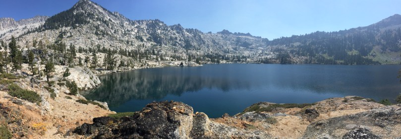
Caribou Basin 3-5 nights

Crossing South Fork Salmon River at start of Caribou Lakes Trail (fill up on water)

Crossing South Fork Salmon River at start of Caribou Lakes Trail (fill up on water)

View of the South Fork Salmon River drainage from Caribou Lakes Trail

View of the Caribou Basin from Caribou Lakes Trail

Descending into Snowslide Lake on Caribou Lake Trail

Snowslide and Lower Caribou Lake from Caribou Lakes Trail (smoke from wildfire)

Snowslide Lake

Snowslide Lake and headwall

Snowslide Lake

Camping at Snowslide Lake

Camping at Snowslide Lake

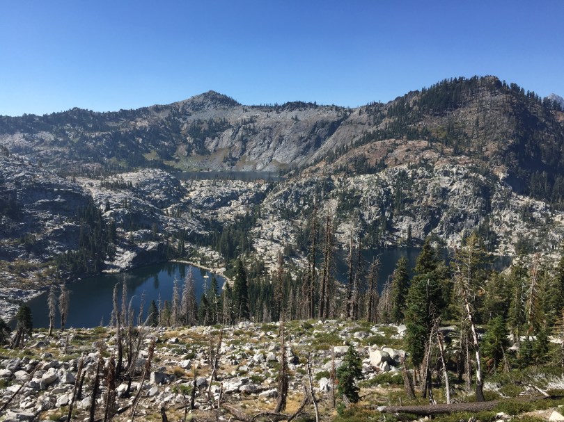
View of Lower Caribou Lake from trail to Upper Caribou Lake

View of Lower and Middle Caribou Lakes from trail to Upper Caribou Lake

Trail to Upper Caribou Lake

Trail to Upper Caribou Lake

Trail to Upper Caribou Lake

Pond near Upper Caribou Lake
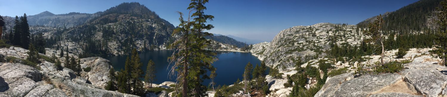
Upper Caribou Lake looking toward Caribou Scramble

Upper Caribou Lake

Upper Caribou Lake

Campsite at Upper Caribou Lake

Trail around Upper Caribou Lake
Upper Caribou Lake looking toward outlet

Upper Caribou Lake looking toward outlet

Meadows near trail to Caribou Scramble

Upper Caribou Lake sunset

Camping at Upper Caribou Lake

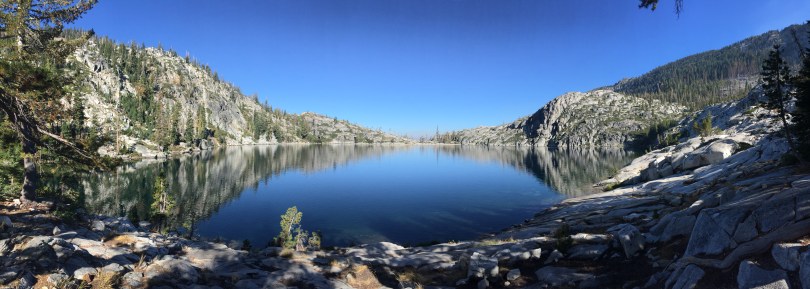
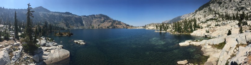
Lower Caribou Lake

Lower Caribou Lake

Granite slab on Lower Caribou Lake

Lower Caribou Lake

Sunset hammock on Lower Caribou Lake

Sunset hammock on Lower Caribou Lake

Hiking out of Caribou Basin

Hiking out of Caribou Basin looking toward Cesear Peak

Hiking out of Caribou Basin

Brown’s Meadows Creek

Brown’s Meadows

Camping at Brown’s Meadows

Brown’s Meadows

Campsite at Brown’s Meadows

Hiking out on the New Caribou Trail looking toward Coffee Creek drainage
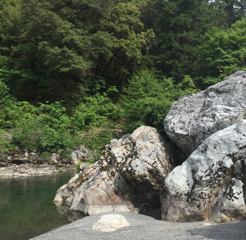
Beautiful, remote Hyampom on the undammed South Fork Trinity River… A small town with a general store located in an isolated valley known for its vineyards and other horticultural endeavors. Free camping can be found at Big Slide Campground and Slide Creek Campground, but don’t expect much for the price. River access is available, including Little Rock Picnic Area, however the camping areas are not located at great swim spots. This is a good base camp, but beware of poison oak. Class III rapids make for fun winter and spring intermediate boating adventures.
The weather in Hyampom tends to be hotter than the surrounding area, and can make for a great swim spot on a day that would be too cold otherwise. Driving from Arcata is about a 2.5 hour drive via Highway 299, turning south at Burnt Ranch on to scenic Road 60 to Hyampom. Getting in or out of Hyampom another way is quite an adventure. Any backroad route connecting Forest Service Road 1 on South Fork Mountain (northern Backcountry Discovery Trail) to Hyampom is 4-wheel drive recommended, signage may not always be present, and that area sees little traffic. Driving southeast from Hyampom toward Highway 3 on Hyampom Road will take about 45 minutes, or take a serious adventure south on Indian Valley Road (FS Road 10) to reach Highway 36 near Forest Glen. The Indian Valley area is known for horseback riding, mountain biking, ATV and motorcycle riding, as well as cross-country skiing the winter.
South Fork Trail 5E23 – This lightly used trail follows the South Fork Trinity River for approximately 7.5 miles. This trail is far above the river, do not expect river access unless you make it to near the end of the trail, and do expect a lot of poison oak. Hell’s Half Acre is famous for its early spring wildflower shows, and very remote setting. There is a spot just south of Hell’s Half Acre that can be daunting or impassible for some, and depending on slide conditions. Camping may exist on the South Fork Trinity River when the trail crosses from the west side to the east side of the river.
MuleBridge – Restored historic hanging mule bridge is in a beautiful and remote spot with great swimming.
Wintoon Flat Trail 7E40 – Southern end of Hyampom on County Road 311, 3.5 miles of trail with some opportunities to find isolated swim spots.
Lower South Fork (North Side) Trail 6E23.2