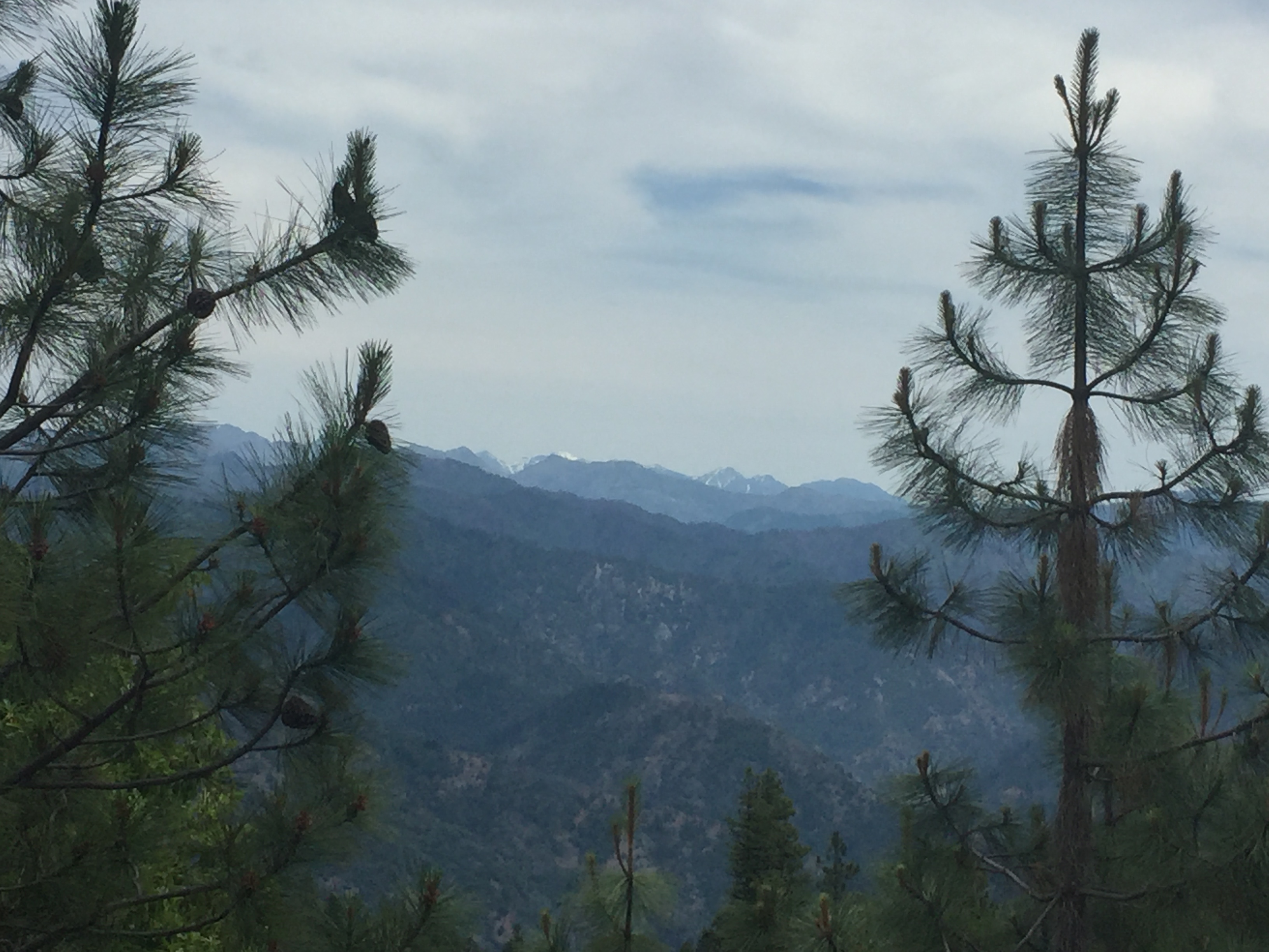
Follow Clear Creek National recreation Trail through the heart of Siskiyou Wilderness for 22 miles. Swim at isolated Wilderness Falls, fish, and explore the Siskiyou Wilderness in any direction. Consider starting at the top of the trail near Youngs Valley, and heading downstream going in a southwest descent toward the Klamath River.
Category: Spring
Marble Mountain PCT
- Marble Mountain Wilderness
- Marble Mountain PCT Adventure
- Seiad Valley Trailhead to Etna Summit Trailhead = 55.8 miles
- Seiad Valley Trailhead to Grider Creek Campground @ 6.5 miles
- Grider Creek Trail at Road 46N72 @ 14.1 miles
- Buckhorn Spring @ 20.8 miles
- Bear Lake – Turk Lake Trails @ 24.8 miles
- Paradise Lake @ 26.4 miles
- Marble Valley Guard Station / Canyon Creek Trail @ 31.7 miles
- Red Rock Valley Trail / Cold Spring Trail @ 35.0 miles
- Older PCT route to Kidder Lake Trail @ 40.2 miles
- Shelly Fork Trail / Shelly Meadows Trail @ 44.6 miles
- Etna Summit @ 55.8 miles
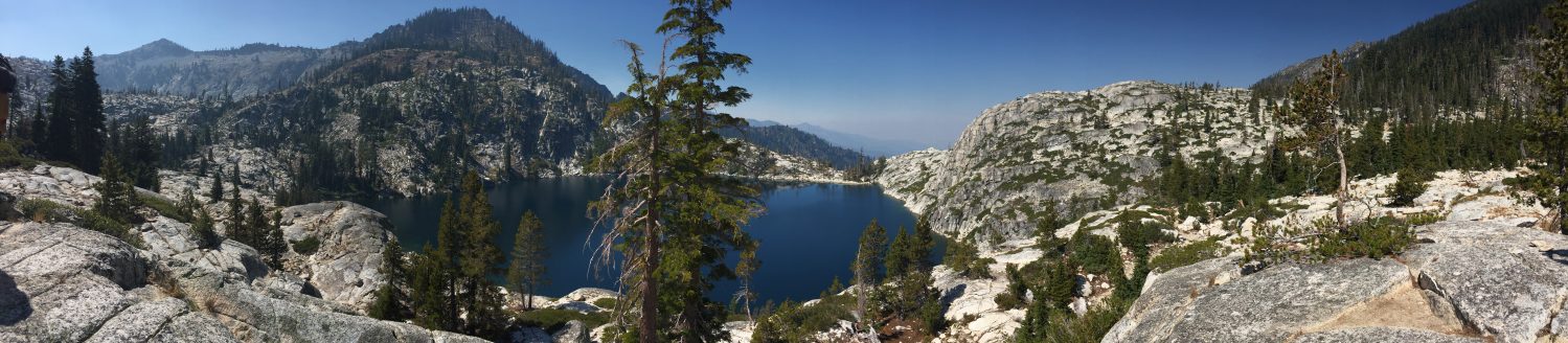
Bear Lakes – Siskiyou Wilderness
Bear Lakes are a moderate 3.15 miles to Bear Lake from the Elbow Springs Trailhead in Siskiyou Wilderness. The primary lake lies at an elevation of 4,850 feet with a small pond above it, while the harder-to-reach Lower Bear Lake is a steep cross-country scramble drop to 4,300 feet. The Bear Lake Trail doesn’t appear to have a number or official name, but is located off the Kelsey Creek National Recreation Trail #4204 near Clear Creek on Highway 96 in Northern California.

Bear Lakes – Zach’s Adventures Article
Bear Lakes – Oregonnator Blog Post
- 2.85 miles one-way, 1.5 hours hiking time

Sierra Nevada Highlights
Blitz through the highlights of the Sierra Nevada while avoiding the crowds…
- Drive to Tahoe through Lassen Volcanic National Park (~7 hours driving)
- Stay at Manzanita Lake Cabins
- Hike to Sierra Buttes Lookout on the way to Tahoe
- Stay at Tahoe State Recreational Area
- Stay at Emerald Bay Boat-In Campground for two nights and paddleboard/kayak the lake for a day
- Stay in Desolation Wilderness for two nights, hike to Lake Aloha and back
- Camp at waterfall camp
- Drive straight to Devil’s Postpile
- Could stay at Grover Hot Springs that night but it burned in the Tamarack Fire of 2011
- Drive from Tahoe to Devil’s Postpile (~3.5 hours driving)
- Hike Ansel Adams Wilderness from Devil’s Postpile area
- Drive Tioga Pass to Yosemite
- Drive from Yosemite to Weaverville (~7 hours)
- Or Add on Seqouia & Kinds Canyon National Parks
- And/Or add on driving back up the Coast
DL Bliss State Park Camping Permits on ReserveCalifornia.com open at 8am PST 6 months before the date:
Note: DL Bliss Campground is not open in 2023 😦
Other Campgrounds to check near DL Bliss:
- Camp Richardson
- Camping Reservations
- $55/night for Single Tent Camping
- $75/night for Partial Hookup RV (No Septic/Greywater)
- $85/night for Full Hookup RV
- Sites 4-35 are close to main road small
- Cabin Reservation
- Camping Reservations
- Emerald Bay State Park
- Lower Eagle Point – Site 77 is private
- Upper Eagle Point – Site 29 is full view
- Boat-In Campground – Site 21 & 22 great view
- Fallen Leaf Campground (not on lake)
- Kaspian Campground
- Meeks Bay Campground
- Nevada Beach Campground
- Sugar Pine State Park
- Tahoe City Recreation Area
- William Kent Campground
Desolation Wilderness Permits: https://www.recreation.gov/permits/233261
Desolation Wilderness Planning Guide with Zone Map: http://desowv.org/files/Desolation_Wilderness_Trip_Planning_Guide_2022_08_18.pdf
Best paddleboarding Spots on Tahoe:
- Carnelian Bay
- Cave Rock
- DL Bliss
- Echo Lakes
- Emerald Bay
Yosemite Camp Sites are reservable 5 months ahead of the date
Yosemite Wilderness Trailhead Maps
John Muir Trail permits ARE NO LONGER through the Yosemite Conservancy only Recreation.gov
Top Trailheads for Permits:
- Happy Isles to Little Yosemite Valley or beyond
- Glen Aulin to Cold Canyon
- Glen Aulin
- Sunrise
- Lyell Canyon (John Muir Trail and PCT)
- White Wolf Campground
- Lukens Lake to Yosemite Creek
- Cathedral Lakes to Half Dome
- Murphy Creek to Clouds Rest
- May Lake
- Porcupine Creek
- Mirror Lake to Snow Creek
https://www.nps.gov/yose/planyourvisit/tuolumne-meadows-backpacking-trails.htm
Hyampom – Trinity County
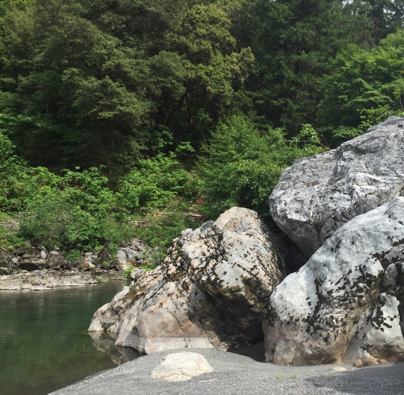
Beautiful, remote Hyampom on the undammed South Fork Trinity River… A small town with a general store located in an isolated valley known for its vineyards and other horticultural endeavors. Free camping can be found at Big Slide Campground and Slide Creek Campground, but don’t expect much for the price. River access is available, including Little Rock Picnic Area, however the camping areas are not located at great swim spots. This is a good base camp, but beware of poison oak. Class III rapids make for fun winter and spring intermediate boating adventures.
The weather in Hyampom tends to be hotter than the surrounding area, and can make for a great swim spot on a day that would be too cold otherwise. Driving from Arcata is about a 2.5 hour drive via Highway 299, turning south at Burnt Ranch on to scenic Road 60 to Hyampom. Getting in or out of Hyampom another way is quite an adventure. Any backroad route connecting Forest Service Road 1 on South Fork Mountain (northern Backcountry Discovery Trail) to Hyampom is 4-wheel drive recommended, signage may not always be present, and that area sees little traffic. Driving southeast from Hyampom toward Highway 3 on Hyampom Road will take about 45 minutes, or take a serious adventure south on Indian Valley Road (FS Road 10) to reach Highway 36 near Forest Glen. The Indian Valley area is known for horseback riding, mountain biking, ATV and motorcycle riding, as well as cross-country skiing the winter.
South Fork Trail 5E23 – This lightly used trail follows the South Fork Trinity River for approximately 7.5 miles. This trail is far above the river, do not expect river access unless you make it to near the end of the trail, and do expect a lot of poison oak. Hell’s Half Acre is famous for its early spring wildflower shows, and very remote setting. There is a spot just south of Hell’s Half Acre that can be daunting or impassible for some, and depending on slide conditions. Camping may exist on the South Fork Trinity River when the trail crosses from the west side to the east side of the river.
MuleBridge – Restored historic hanging mule bridge is in a beautiful and remote spot with great swimming.
Wintoon Flat Trail 7E40 – Southern end of Hyampom on County Road 311, 3.5 miles of trail with some opportunities to find isolated swim spots.
Lower South Fork (North Side) Trail 6E23.2