Duck Lakes – Russian Wilderness

  • 4 miles to Big Duck Lake, 0.5 miles further to Little Duck Lake
  • 2+ Day Trip

Details:

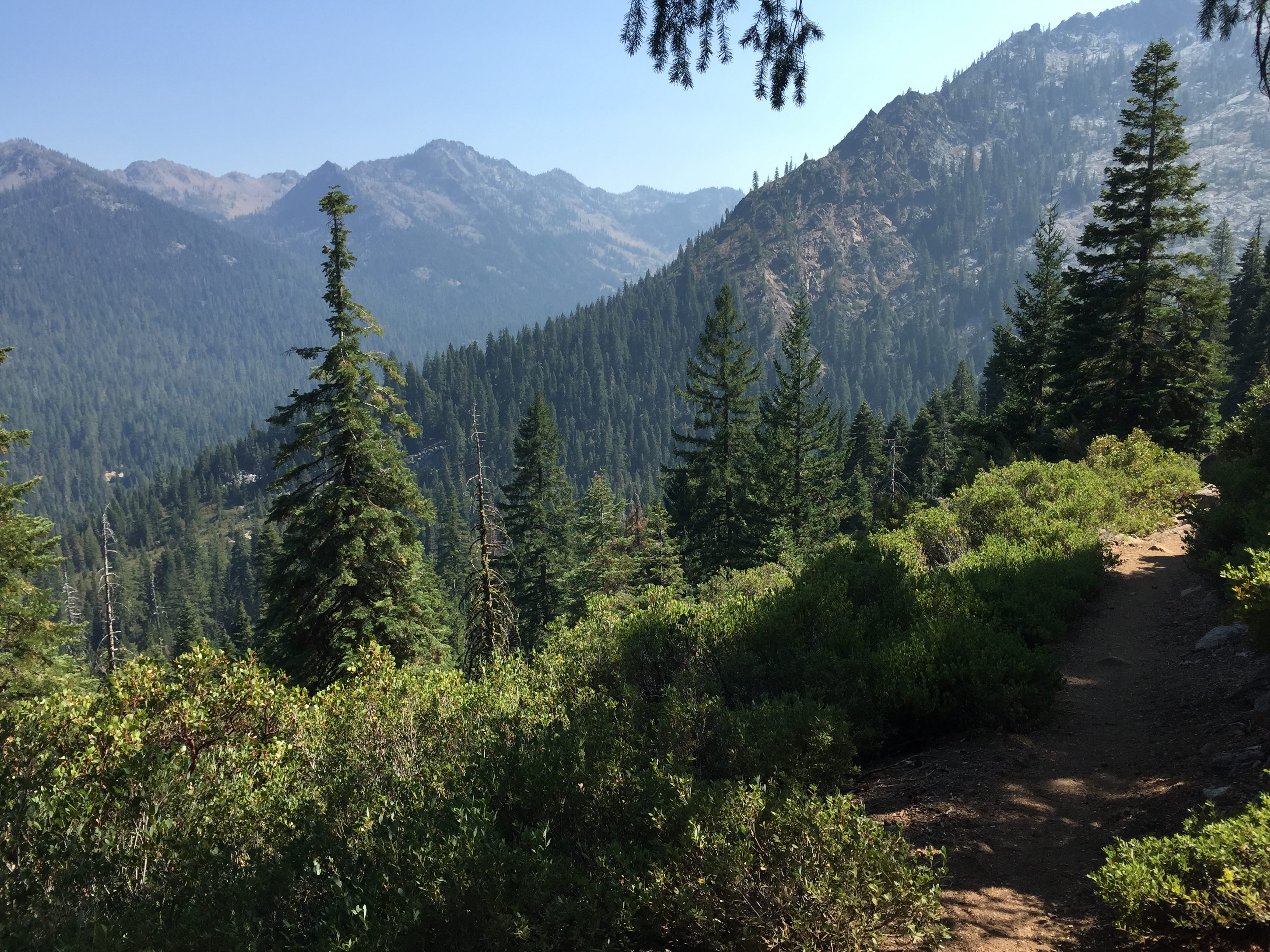
  • Best season = June to October
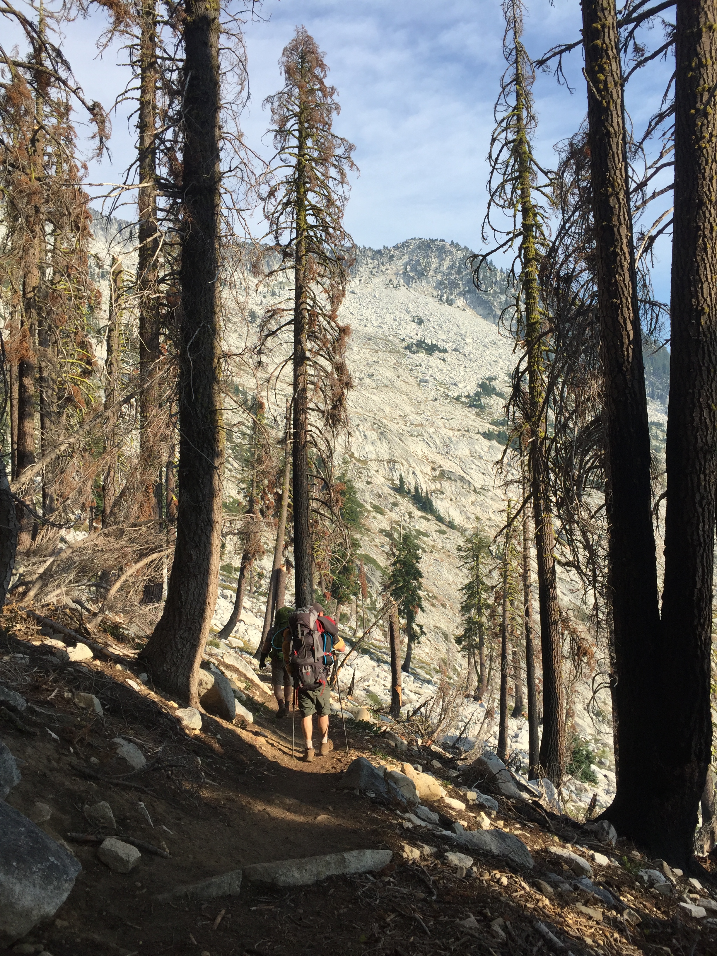
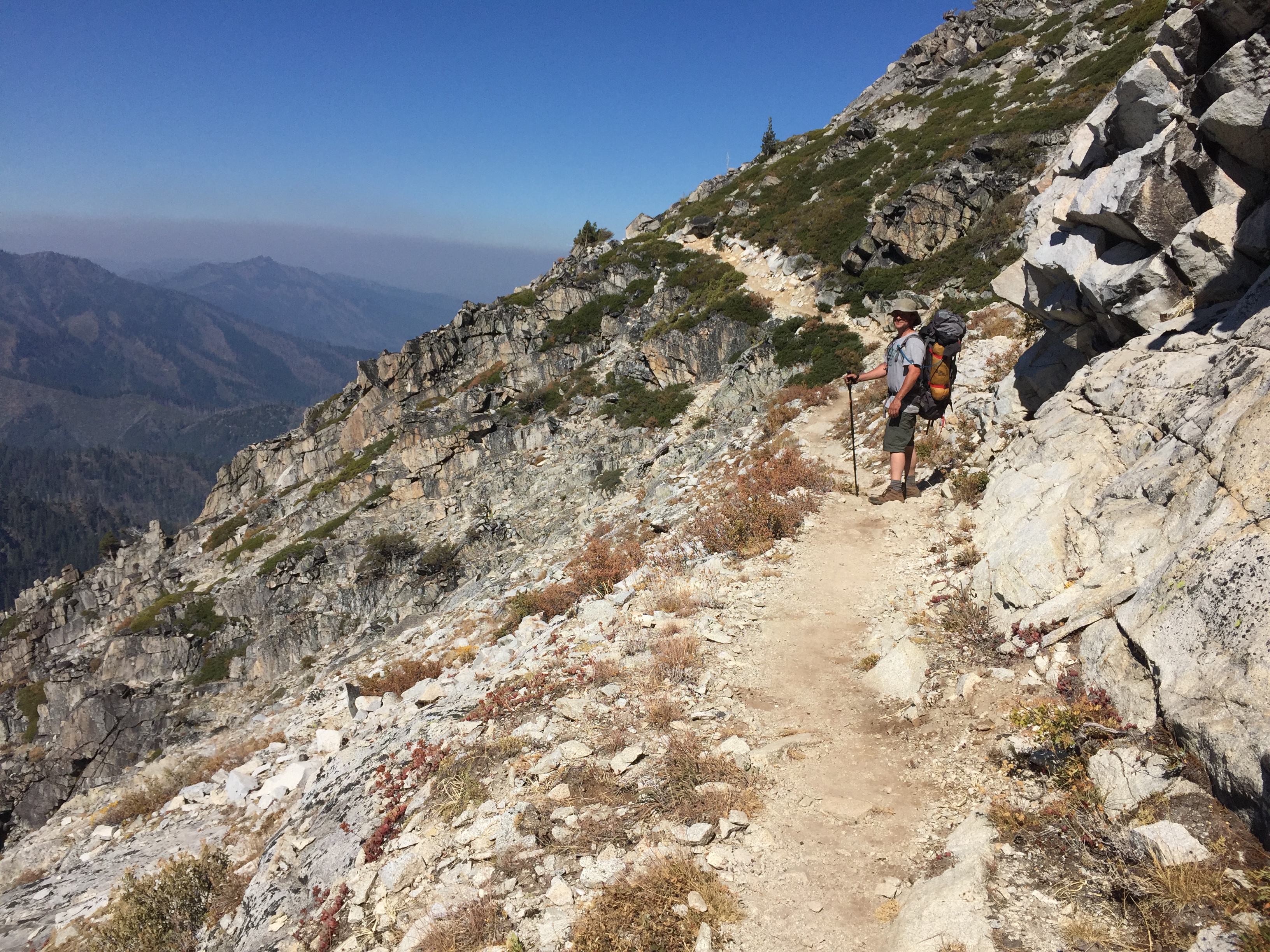
  • Moderately strenuous hike
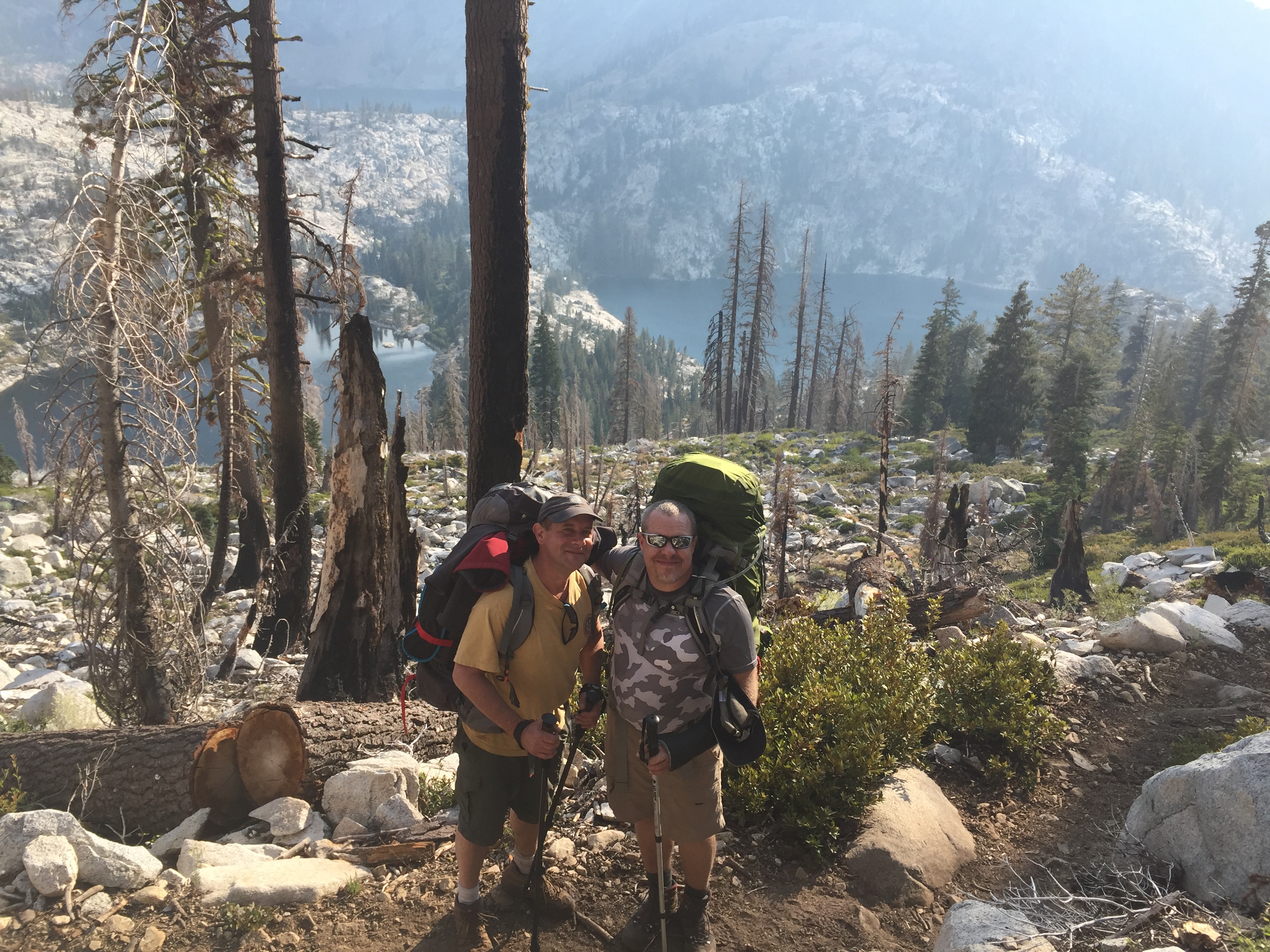
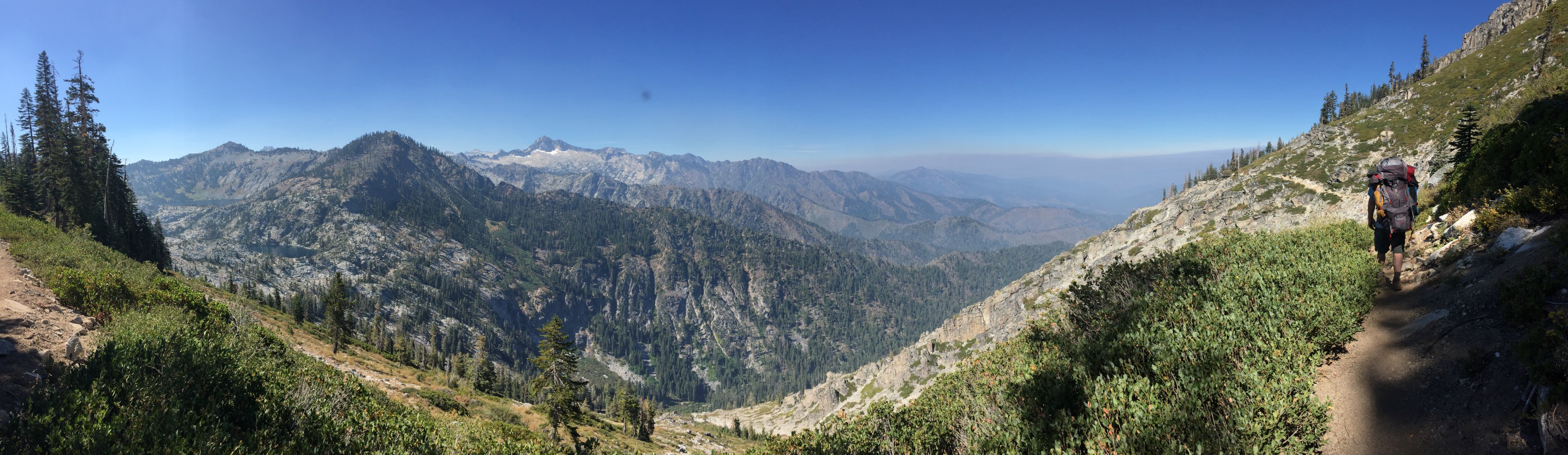
  • Great views to Mount Shasta, Salmon Mountains and Scott Valley
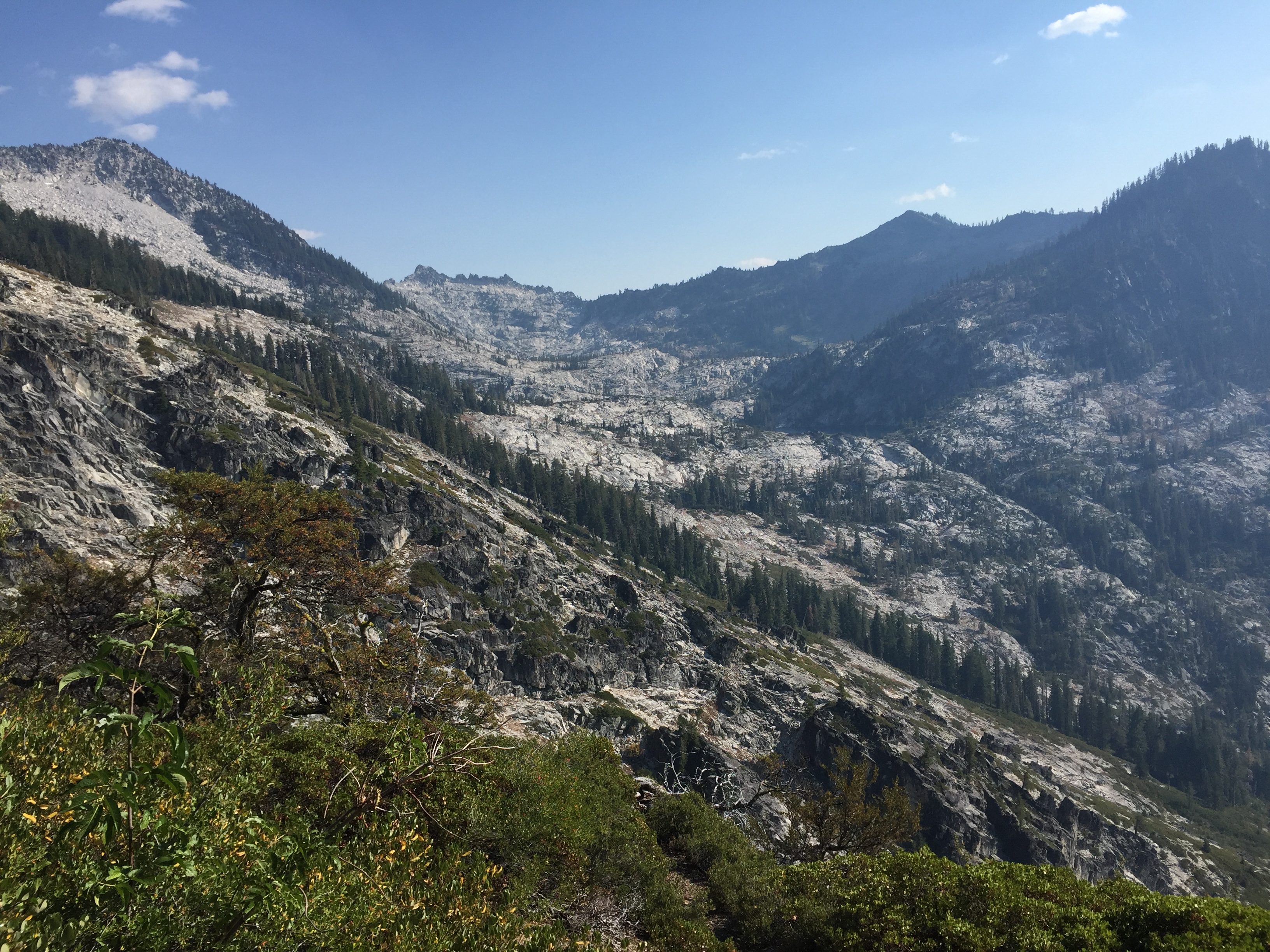
  • Duck Lake Special Interest Area/Botanical Area
    • Known as the Miracle Mile, 17 conifer species are present in the drainage
    • Relic species: Foxtail pine, Englemann spruce, subalpine and Pacific silver fir
  • Approximately 4 hour drive from Eureka, CA on Highway 299 to 3 near Callahan:
    • From Highway 3 between Callahan and Etna, CA
    • Turn west on French Creek Road for 6.7 miles
    • Right on 40N22 for 1 mile
    • Right on 41N14 for 1.3 miles to parking area
  • Hiking to Duck Lakes from Duck Lake Trailhead @ 4800 feet elevation:
    • 4 mile moderate hike from Duck Lake Trailhead to Big Duck Lake
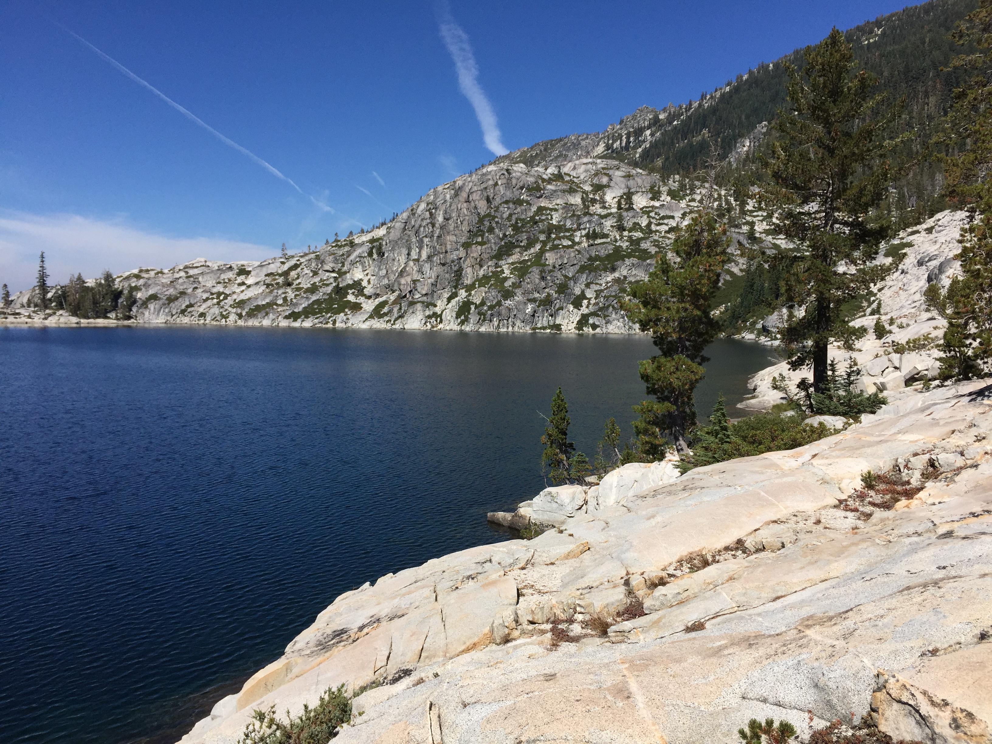
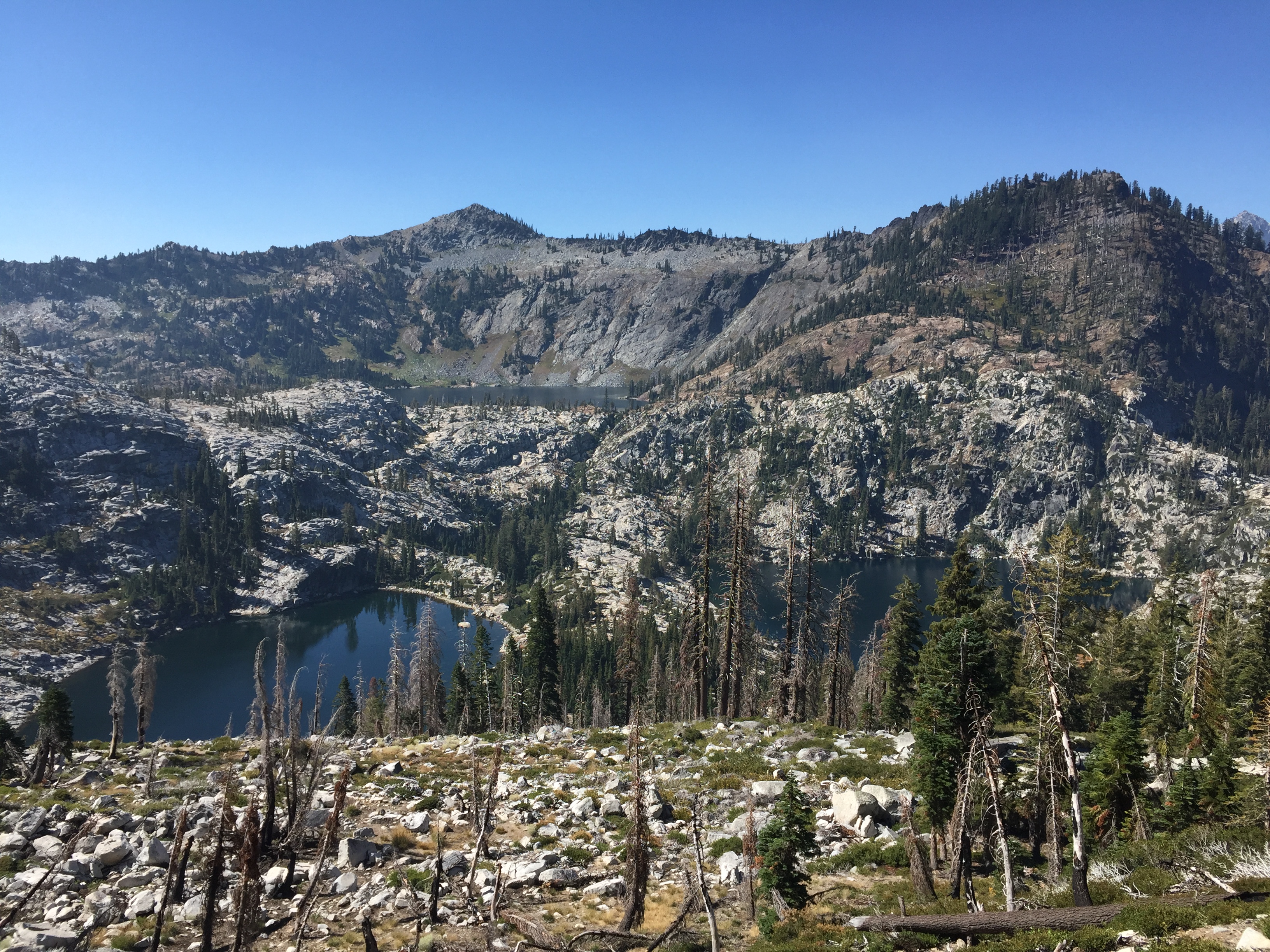
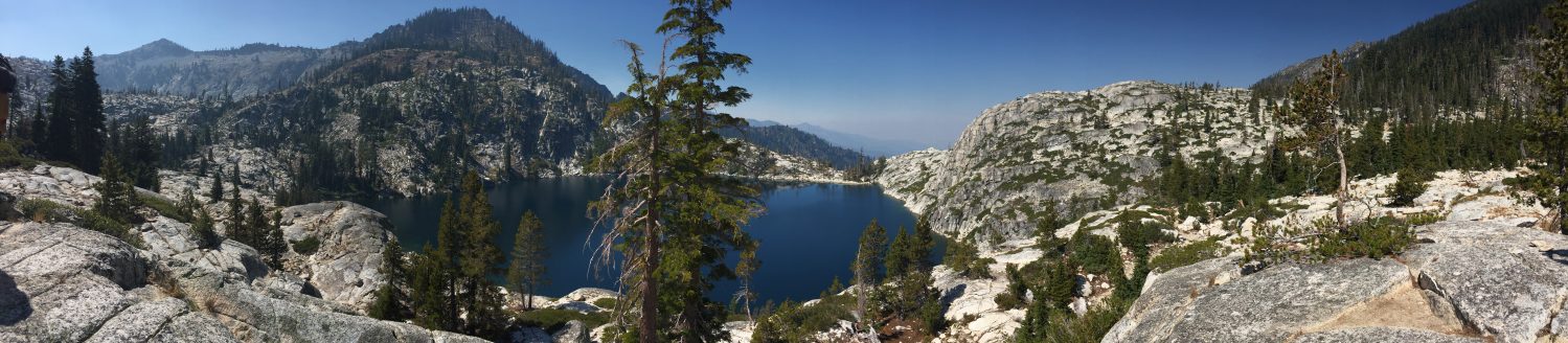
      • Big Duck Lake = 26 acres @ 27 feet deep @ 6400 feet elevation
      • Eastern brook trout and rainbow trout
      • Largest lake in the Russian Wilderness
      •  0.5 mile difficult hike with 700 foot elevation gain to Little Duck LakeLittle Duck Lake = 5 acres @ 18 feet deep @ 6700 feet elevation
        • Eastern brook trout
  • Hiking to Horseshoe Lake:
    • 4 mile moderate hike from Duck Lake Trailhead to Horseshoe Lake
    • 1.5  mile moderate hike from Duck/Eaton Lakes Trail intersection
      • Horseshoe Lake = 6.1 acres @ 21 feet deep @ 6400 feet elevation
      • Eastern brook trout and rainbow trout
  • Hiking to Lipstick Lake:
    • 4 mile difficult hike from Duck Lake Trailhead to Horseshoe Lake
    • 3 mile moderate hike from Music Creek Trailhead to Horseshoe Lake
      • Horseshoe Lake = 1.25 acres @ 9 feet deep @ 6350 feet elevation
      • Eastern brook trout
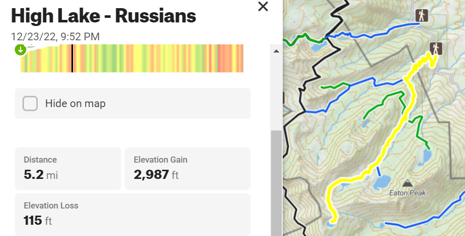
  • Hiking to Eaton Lakes:
    • 4.5 mile difficult hike from Duck Lake Trailhead to Eaton Lake
    • Approximately 1 mile difficult hike from Duck/Eaton Lakes Trail intersection
      • Eaton Lake = 11 acres @ 27 feet deep @ 6600 feet elevation
      • Trail is steep and hard to follow, not recommended for stock
      • Private property
      • Rainbow trout

Links:

  • Driving Directions – About 4 hours from Eureka, CA via Highway 299 to 3
  • Alternative Scenic Route: Salmon River Road

Russian Wilderness

Nor-Cal Adventures Blog Pages:

Helpful links to other pages:

Hiking Trails:

Hiking Trails:

  • High Lake from Little Duck Lake = 5.2 miles
  • South Sugar Lake from Bingham Trail pass = 1.5 miles

Big Blue Loop = 8.5 miles

High Lake from Duck Lake Trailhead via Little Duck Lake = 5.2 miles w/XC

South Sugar Lake from Bingham Lake Trailhead = 1.5 miles w/ XC

Russian Lake = 4 miles

Caribou Lakes – Trinity Alps

Caribou Basin 3-5 nights

south-fork-salmon-crossing

Crossing South Fork Salmon River at start of Caribou Lakes Trail (fill up on water)

south-fork-salmon-looking-downriver

Crossing South Fork Salmon River at start of Caribou Lakes Trail (fill up on water)

img_2487

View of the South Fork Salmon River drainage from Caribou Lakes Trail

img_2495

View of the Caribou Basin from Caribou Lakes Trail

img_2536

Descending into Snowslide Lake on Caribou Lake Trail

img_2540

Snowslide and Lower Caribou Lake from Caribou Lakes Trail (smoke from wildfire)

img_2548

Snowslide Lake

img_2544

Snowslide Lake and headwall

img_2590

Snowslide Lake

img_2555

Camping at Snowslide Lake

img_2563

Camping at Snowslide Lake

img_2580

View of Lower Caribou Lake from trail to Upper Caribou Lake

img_2603

View of Lower and Middle Caribou Lakes from trail to Upper Caribou Lake

img_2595

Trail to Upper Caribou Lake

img_2601

Trail to Upper Caribou Lake

img_2608

Trail to Upper Caribou Lake

img_2617

Pond near Upper Caribou Lake

img_2621

Upper Caribou Lake looking toward Caribou Scramble

img_2625

Upper Caribou Lake

img_2635

Upper Caribou Lake

img_2632

Campsite at Upper Caribou Lake

img_2656

Trail around Upper Caribou Lake

img_2677

Upper Caribou Lake looking toward outlet

img_2670

Upper Caribou Lake looking toward outlet


img_2705

Meadows near trail to Caribou Scramble

img_2717

Upper Caribou Lake sunset

img_2747

Camping at Upper Caribou Lake

img_2765

Lower Caribou Lake

img_2925

Lower Caribou Lake

img_2812

Granite slab on Lower Caribou Lake

img_2786

Lower Caribou Lake

img_2905

Sunset hammock on Lower Caribou Lake

img_2956

Sunset hammock on Lower Caribou Lake

img_2993

Hiking out of Caribou Basin

img_3015

Hiking out of Caribou Basin looking toward Cesear Peak

img_3008

Hiking out of Caribou Basin

img_3082

Brown’s Meadows Creek

img_3087

Brown’s Meadows

img_3104

Camping at Brown’s Meadows

img_3107

Brown’s Meadows

img_3108

Campsite at Brown’s Meadows

img_3118

Hiking out on the New Caribou Trail looking toward Coffee Creek drainage

Kidder Creek to Shelly Fork

  • 60 miles of isolated trekking exploring most of the Marble Mountains

  1. Kidder Creek Trail #5545
  2. Pacific Crest Trail to Four Corners near Marble Rim
  3. Kelsey National Recreation Trail to Cuddihy Lakes
  4. Bridge Creek Trail #5816 south to Wooley Creek Trail #5832 heading northeast
  5. Big Meadows Trail #5411 south to North Fork Trail #5405 east
  6. Right Hand Fork Trail #5401 east to Shelly Fork Trail #5527
  7. End at Shelley Fork Trailhead

High & Sugar Lakes

  • Forest Service Road 41N14, turn left and go 3 miles for Sugar Creek Trail
  • Faint trail to Sugar Lake, not well-marked, recreation is not promoted to protect the botanical diversty of the area
  • 4+ miles from Sugar Creek Trailhead to High Lake, no trail from Sugar Lake
  • Second highest lake in Russian Wilderness after Josephine Lake
  • Brown and rainbow trout

From the Sugar Creek Trailhead:

  • @ 1.5 miles, turn off to South Sugar Lake Trail = 1.5 miles to South Sugar Lake
  • @ 3 miles to Sugar Lake (4800-5900 feet)
    • 2.5 acres, 6 feet deep, 5900 feet elevation, rainbow trout
  • @ 1+ miles from Sugar Lake, follow inlet creek northwest to ridge between Sugar and Little Duck Lakes, the contour south for 1.8 mile

highlake


High & Sugar Lakes – Russian Wilderness

  • Forest Service Road 41N14, turn left and go 3 miles for Sugar Creek Trail
  • Faint trail to Sugar Lake, not well-marked, recreation is not promoted to protect the botanical diversty of the area
  • 4+ miles from Sugar Creek Trailhead to High Lake, no trail from Sugar Lake
  • Second highest lake in Russian Wilderness after Josephine Lake
  • Brown and rainbow trout

From the Sugar Creek Trailhead:

  • @ 1.5 miles, turn off to South Sugar Lake Trail = 1.5 miles to South Sugar Lake
  • @ 3 miles to Sugar Lake (4800-5900 feet)
    • 2.5 acres, 6 feet deep, 5900 feet elevation, rainbow trout
  • @ 1+ miles from Sugar Lake, follow inlet creek northwest to ridge between Sugar and Little Duck Lakes, the contour south for 1.8 mile

highlake