Category: Humboldt County
Humboldt
Redwoods
DEL NORTE COUNTY REDWOODS
HUMBOLDT COUNTY REDWOODS
- Redwood National Park
- Humboldt Redwoods State Park
- Prairie Creek Redwoods State Park
- Arcata Community Forest
MENDOCINO COUNTY REDWOODS
MISC REDWOODS
Coastal Trail
- California Coastal Trail
- Hiking the Coastal Trail book by Rob Lorentzen and Richard Nichols
- Coastal Trail in Del Norte County
- Last Chance Section = 13 miles
- DeMartin Section = 12.6 miles
- Hidden Beach Section = 7.8 miles
- Coastal Trail in Humboldt County
- Gold Bluffs Beach Section
- Skunk Cabbage Section = 7.6 miles
- Redwood Creek Section
- Stone Lagoon Section
- Big Lagoon Section
- Patrick’s Point Section
- Stagecoach Road Section
- Little River and Clam Beach Section
- Hammond Trail
- Mad River Beach
- Lanphere Dunes
- Manila Dunes
- Samoa Dunes
- Bay Route
- Table Bluff Section
- Centerville Beach
- Mattole Road
- Lost Coast Trail
- Coastal Trail in Mendocino County
- Sinkyone Trail
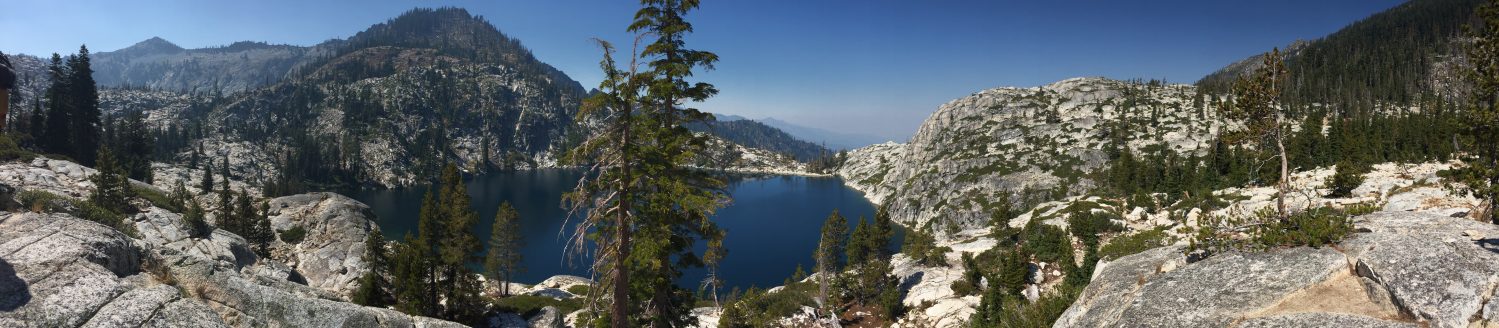
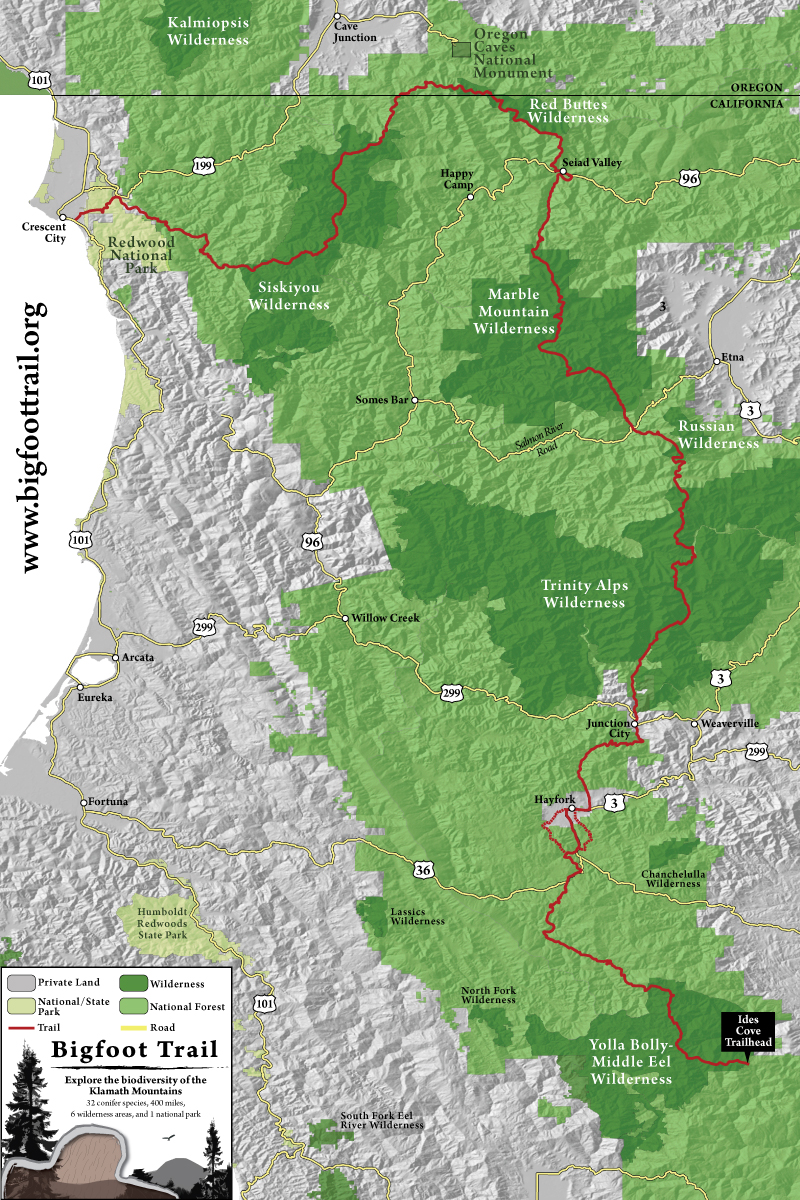
Bigfoot Trail
- Bigfoot Trail Alliance
- 360 miles through 32 conifer species in the Klamath Mountains
- 8 sections of the Trail:
- List of conifers species on Bigfoot Trail
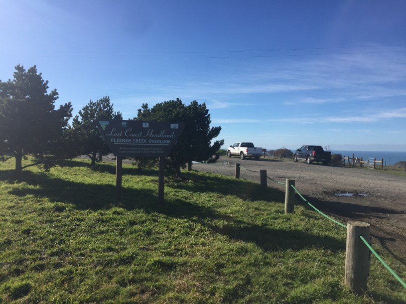
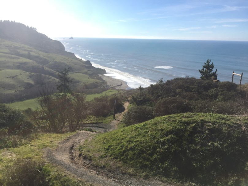
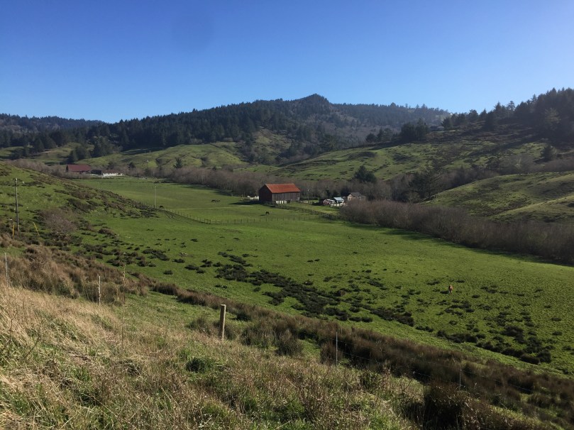
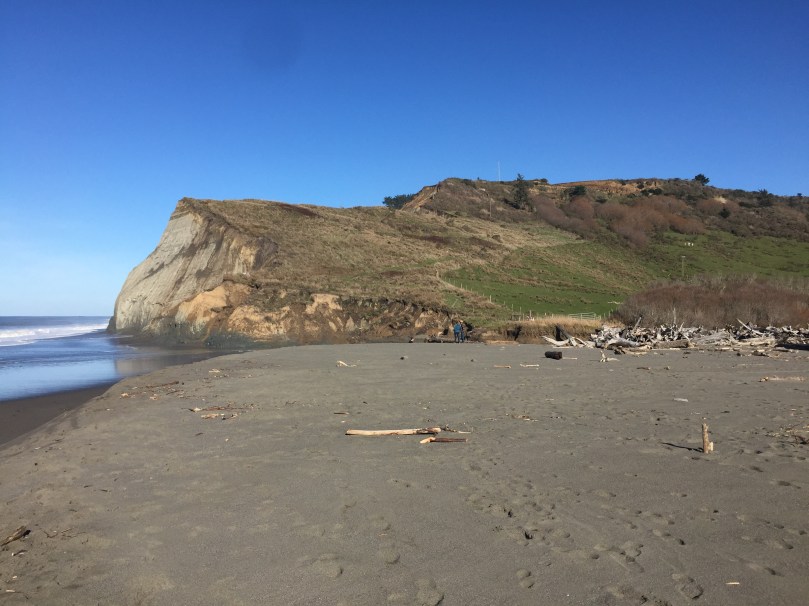
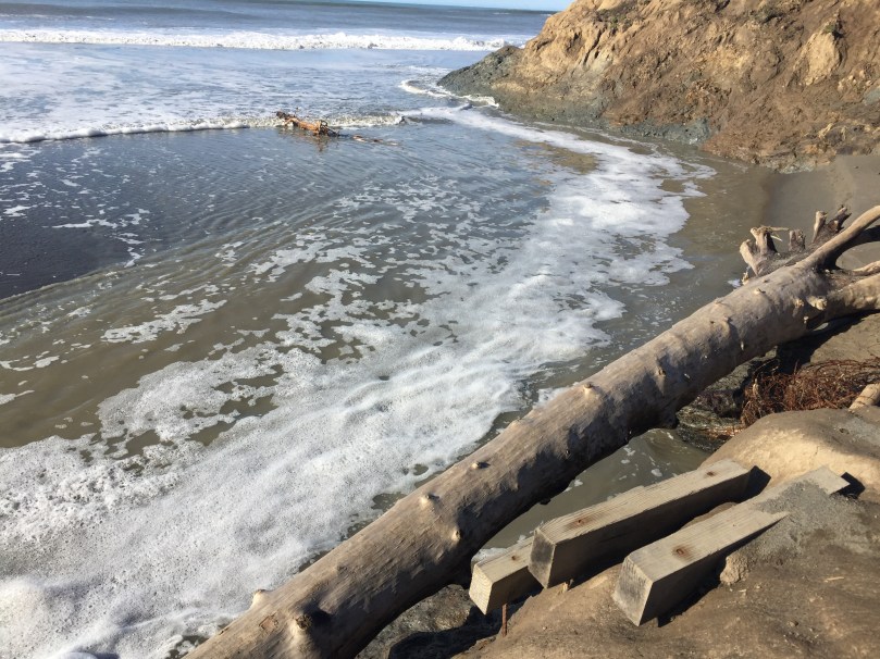
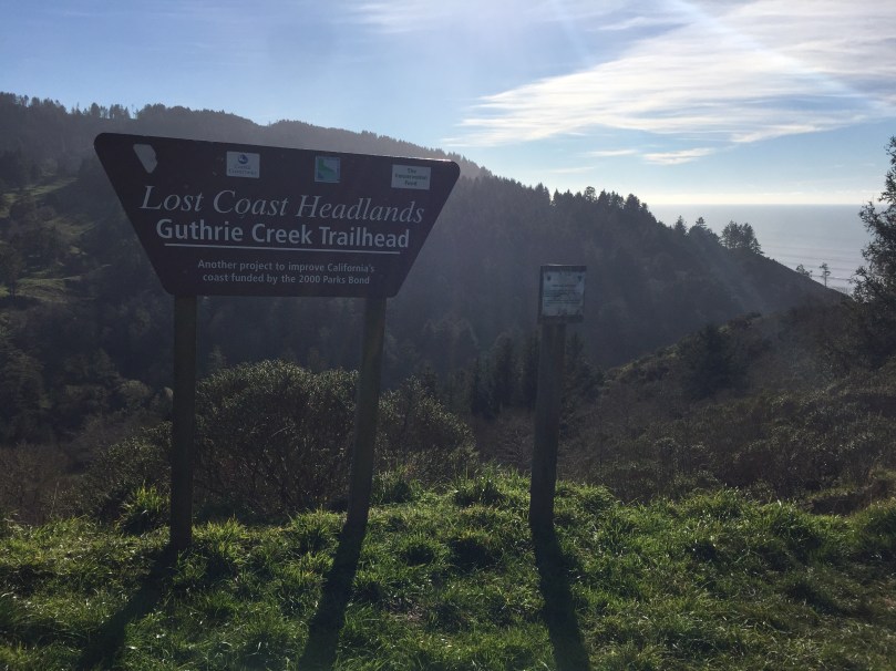
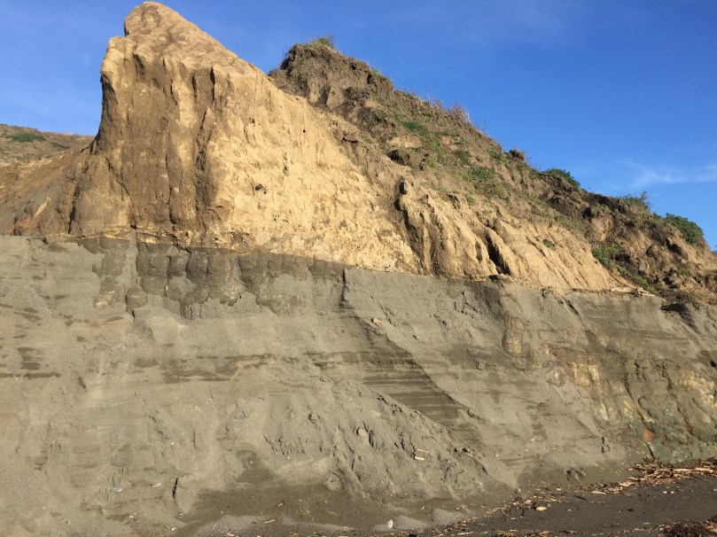
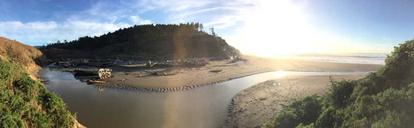
Lost Coast Headlands
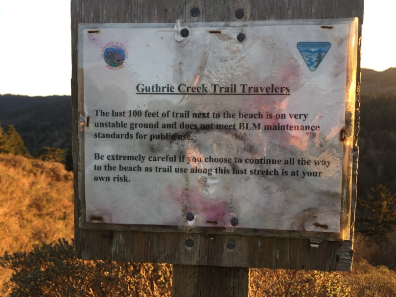
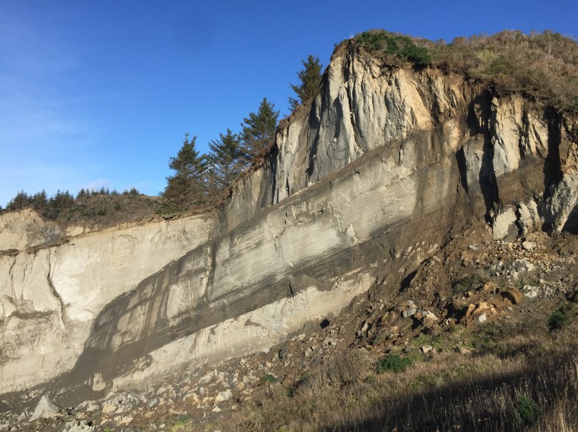
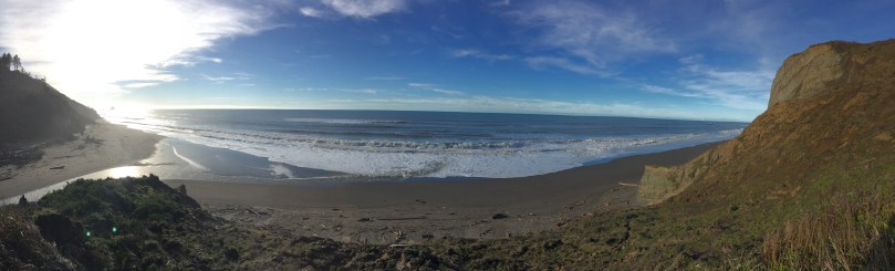
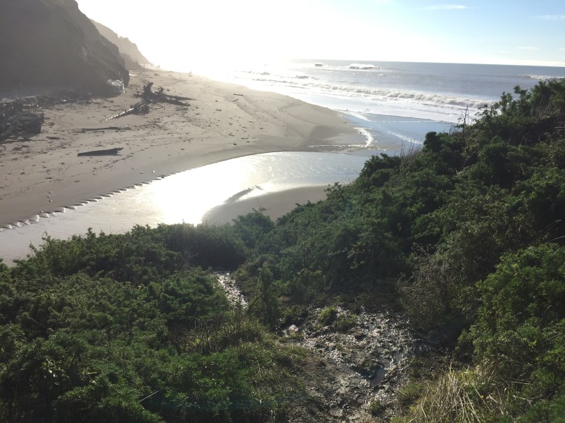
Lost Coast Headlands consists of two moderate trails to secluded, rugged beaches, at the end of the road to Centerville Beach in Ferndale. The first is Fleener Creek Trail, 0.5 miles downhill to the beach. Guthrie Creek Trail is 1.0 miles downhill to the beach. Both can be difficult and possibly unsafe in muddy conditions, especially Guthrie Creek Trail that has a steep muddy patch right before the beach that some people were turning back from. Fleener Creek Trail has a large driftwood pile that must be carefully crossed, or short wood stairs leading to a creek crossing, after a steep muddy descent to the beach that a sign at the trailhead warns about. If you have bad knees or ankles, you might not want to try these trails in winter, and walking poles are recommended.
- Redwoods.info
- California Coastal Monument – BLM
- YourCaliforniaCoast.org
- 360 degree panoramas of Lost Coast Headlands
- Lost Coast Interpretive Association
- Lost Coast Trails Blog
- Guthrie Creek Trail rockslide video
- Lost Coast Headlands added to California Coastal Monument
FLEENER CREEK TRAIL – PHOTOS


GUTHRIE CREEK TRAIL – PHOTOS


Lost Coast Trail
- Lost Coast
- BLM Lost Coast Trail
- Lost Coast National Recreation Trail
- lostcoasttrails.wordpress.com
- Sinkyone Wilderness
NORTHERN LOST COAST TRAIL
- 24.8 miles along the Pacific Ocean north of Shelter Cove
- Mattole Beach to Black Sand Beach in Shelter Cover
- 3-4 days each way
- Usually hiked north to south for wind reasons
SOUTHERN LOST COAST TRAIL
- 22.1 miles along the Pacific Ocean south of Shelter Cove
- Needle Rock Beach to Usal Beach
- 3-4 days each way
- Usually hiked north to south for wind reasons

Humboldt County Parks
- Arcata Community Forest (City of Arcata)
- Arcata Marsh and Wildlife Sanctuary (City of Arcata)
- A.W. Way County Park
- Big Lagoon County Park
- Centerville County Park and Beach
- Clam Beach County Park
- Crab Park
- Jimmy Smith Fields Landing Boat Launching Facility
- Freshwater Park
- Headwaters Forest Reserve
- Jacoby Creek Community Forest
- Lacks Creek BLM Management Area
- Luffenholtz Beach & County Park
- Ma-le’l Dunes Cooperative Management Area
- Mad River Beach County Park
- Margerite Lockwood Park
- McKay Community Forest
- Moonstone Beach County Park
- Pedrazzini Boat Ramp
- Samoa County Park
- Table Bluff County Park
- Van Duzen County Park
Humboldt State Parks
- Azalea State Reserve
- Dewitt Redwoods State Natural Reserve
- Fort Humboldt State Historic Park
- Harry A. Merlo State Recreation Area
- Little River State Beach
- Benbow State Recreation Area
- Grizzly Creek Redwoods State Park
- Humboldt Lagoons State Park
- Humboldt Redwoods State Park
- Lost Coast Headlands
- Patrick’s Point State Park
- Prairie Creek Redwoods State Park
- Richardson Grove State Park
- Punta Gorda Lighthouse
- Trinidad State Beach
- Samoa Dunes State Recreation Area
Lost Coast
The Lost Coast is a rugged coastal wilderness that feels like an escape to another world. As the longest undeveloped coastal region in the contiguous US, you can hike along the ocean for days.
- BLM King Range Conservation Area
- 68,000 acres
- King Range Wilderness
- 42,694 acres
- King Range Trail Map
- King Range Road Map
- Lost Coast Trails Blog
- Lost Coast Scenic Drive
- Punta Gorda Lighthouse
- Lost Coast Headlands
- Paradise Royale Mountain Biking Trail
- Surf the Lost Coast – National Geographic

