Caribou Lakes – Trinity Alps

Caribou Basin 3-5 nights

south-fork-salmon-crossing

Crossing South Fork Salmon River at start of Caribou Lakes Trail (fill up on water)

south-fork-salmon-looking-downriver

Crossing South Fork Salmon River at start of Caribou Lakes Trail (fill up on water)

img_2487

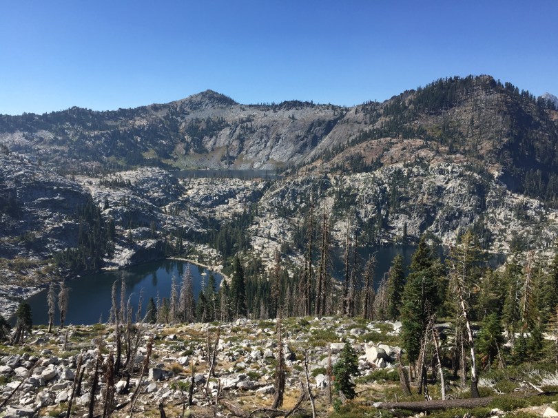
View of the South Fork Salmon River drainage from Caribou Lakes Trail

img_2495

View of the Caribou Basin from Caribou Lakes Trail

img_2536

Descending into Snowslide Lake on Caribou Lake Trail

img_2540

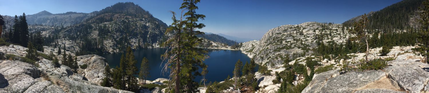
Snowslide and Lower Caribou Lake from Caribou Lakes Trail (smoke from wildfire)
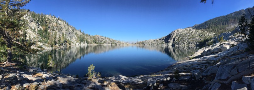
img_2548

Snowslide Lake

img_2544

Snowslide Lake and headwall

img_2590

Snowslide Lake

img_2555

Camping at Snowslide Lake

img_2563

Camping at Snowslide Lake

img_2580

View of Lower Caribou Lake from trail to Upper Caribou Lake

img_2603

View of Lower and Middle Caribou Lakes from trail to Upper Caribou Lake

img_2595

Trail to Upper Caribou Lake

img_2601

Trail to Upper Caribou Lake

img_2608

Trail to Upper Caribou Lake

img_2617

Pond near Upper Caribou Lake

img_2621

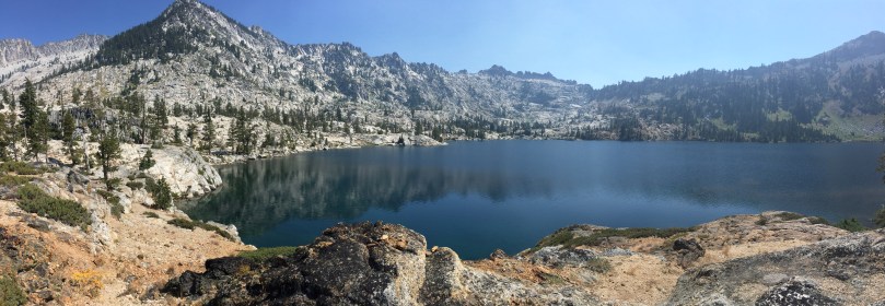
Upper Caribou Lake looking toward Caribou Scramble

img_2625

Upper Caribou Lake

img_2635

Upper Caribou Lake

img_2632

Campsite at Upper Caribou Lake

img_2656

Trail around Upper Caribou Lake

img_2677

Upper Caribou Lake looking toward outlet

img_2670

Upper Caribou Lake looking toward outlet


img_2705

Meadows near trail to Caribou Scramble

img_2717

Upper Caribou Lake sunset

img_2747

Camping at Upper Caribou Lake
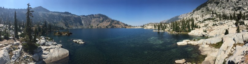
img_2765

Lower Caribou Lake

img_2925

Lower Caribou Lake

img_2812

Granite slab on Lower Caribou Lake

img_2786

Lower Caribou Lake

img_2905

Sunset hammock on Lower Caribou Lake

img_2956

Sunset hammock on Lower Caribou Lake

img_2993

Hiking out of Caribou Basin

img_3015

Hiking out of Caribou Basin looking toward Cesear Peak

img_3008

Hiking out of Caribou Basin

img_3082

Brown’s Meadows Creek

img_3087

Brown’s Meadows

img_3104

Camping at Brown’s Meadows

img_3107

Brown’s Meadows

img_3108

Campsite at Brown’s Meadows

img_3118

Hiking out on the New Caribou Trail looking toward Coffee Creek drainage

Kidder Creek to Shelly Fork

  • 60 miles of isolated trekking exploring most of the Marble Mountains
  1. Kidder Creek Trail #5545
  2. Pacific Crest Trail to Four Corners near Marble Rim
  3. Kelsey National Recreation Trail to Cuddihy Lakes
  4. Bridge Creek Trail #5816 south to Wooley Creek Trail #5832 heading northeast
  5. Big Meadows Trail #5411 south to North Fork Trail #5405 east
  6. Right Hand Fork Trail #5401 east to Shelly Fork Trail #5527
  7. End at Shelley Fork Trailhead

Russian Wilderness Weeklong Trip

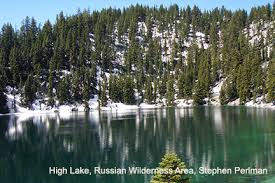
Starts at Deacon Lee Trailhead, ends at Etna Summit, captures highlights of Pacific Crest Trail in Russian Wilderness. Possibly not clear of snow until late June/July.

7-Day Trip

  1. Russian Lake @ 4 miles from Deacon Lee Trailhead
  2. Russian Lake  – Crosscountry day hike to lakes
    1. Waterdog Lake @ 0.5 miles from Russian Lake
    2. Lower Russian Lake – No trail
    3. Upper Russian Lake – No trail
    4. Golden Russian Lake – No trail
  3. Bingham Lake @ 3 miles from Russian Lake
    1. Siphon Lake @ 1 mile from Russian Lake
    2. Pacific Crest Trail @ 0.5 mile from Siphon Lake
    3. Bingham Lake outlet @1.5 miles from PCT Intersection with Siphon Lake
  4. Upper Albers Lake @ 0.5 miles from Paynes LakePacific Crest Trail
    1. Statue Lake (3.3 miles from Statue Lake to Paynes Lake via PCT)
    2. Paynes Lake @ 8.5 miles from PCT junction
    3. Big Blue Lake day hike
  5. Smith Lake @ ? miles from Paynes Lake
    1. Meeks Meadow Lake
    2. Ruffey Lakes
  6. End at parking area on Etna Summit 

High & Sugar Lakes – Russian Wilderness

  • Forest Service Road 41N14, turn left and go 3 miles for Sugar Creek Trail
  • Faint trail to Sugar Lake, not well-marked, recreation is not promoted to protect the botanical diversty of the area
  • 4+ miles from Sugar Creek Trailhead to High Lake, no trail from Sugar Lake
  • Second highest lake in Russian Wilderness after Josephine Lake
  • Brown and rainbow trout

From the Sugar Creek Trailhead:

  • @ 1.5 miles, turn off to South Sugar Lake Trail = 1.5 miles to South Sugar Lake
  • @ 3 miles to Sugar Lake (4800-5900 feet)
    • 2.5 acres, 6 feet deep, 5900 feet elevation, rainbow trout
  • @ 1+ miles from Sugar Lake, follow inlet creek northwest to ridge between Sugar and Little Duck Lakes, the contour south for 1.8 mile

highlake


High & Sugar Lakes

  • Forest Service Road 41N14, turn left and go 3 miles for Sugar Creek Trail
  • Faint trail to Sugar Lake, not well-marked, recreation is not promoted to protect the botanical diversty of the area
  • 4+ miles from Sugar Creek Trailhead to High Lake, no trail from Sugar Lake
  • Second highest lake in Russian Wilderness after Josephine Lake
  • Brown and rainbow trout

From the Sugar Creek Trailhead:

  • @ 1.5 miles, turn off to South Sugar Lake Trail = 1.5 miles to South Sugar Lake
  • @ 3 miles to Sugar Lake (4800-5900 feet)
    • 2.5 acres, 6 feet deep, 5900 feet elevation, rainbow trout
  • @ 1+ miles from Sugar Lake, follow inlet creek northwest to ridge between Sugar and Little Duck Lakes, the contour south for 1.8 mile

highlake