Category: Driving/Riding Activities
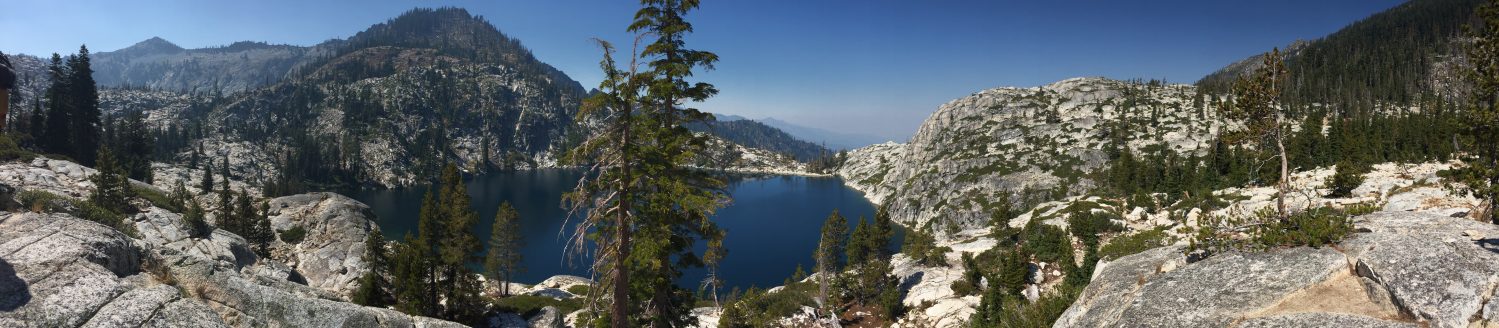
Drive-Up Lakes
Sierra Highways and Passes
- Highway 80
- Sacramento to Truckee/Reno
- Tahoe National Forest
- Highway 50
- Echo Summit 7379ft
- Sacramento to Lake Tahoe
- Eldorado National Forest
- Highway 108
- Sonora Pass 9609ft
- Modesto/Pinecrest Lake
- Stanislaus National Forest
- Highway 49
- Highway 36
- Red Bluff to Chester/Lake Almanor
- Highway 70
- Oroville to Portola
- Highway 120
- Tioga Pass 9944ft
- Modesto to Yosemite to Mono Lake
- Yosemite National Park
- Highway 4
- Ebbetts Pass 8756ft
- Stockton to Markleeville
- Stanislaus National Forest
- Highway 88
- Yuba Pass 6800ft
- Stockton to Markleeville
- Caples Lake
- Stanislaus National Forest
- Highway 89
- Highway 178
- Bakersfield to Ridgecrest
- Sequoia National Forest
North Coast Railroad
Redwoods
DEL NORTE COUNTY REDWOODS
HUMBOLDT COUNTY REDWOODS
- Redwood National Park
- Humboldt Redwoods State Park
- Prairie Creek Redwoods State Park
- Arcata Community Forest
MENDOCINO COUNTY REDWOODS
MISC REDWOODS
Salmon River
- Salmon/Scott River Ranger District – Klamath National Forest
- Ukonom Ranger District – Six Rivers National Forest
- Marble Mountain Wildnerness
- Russian Wilderness
- Trinity Alps Wilderness
- Otter Bar Kayak School
- Whitewater Rafting
- Salmon River Saloon and Gas Station in Cecilville
- Salmon River Disc Golf Club and Course
- Salmon River Outpost Store in Somes Bar on Highway 96
CAMPING
Camping – Main Stem Salmon River
Camping – North Fork Salmon River
Camping – South Fork Salmon River
Redwood Bike Trails
- Last Chance Section – Coastal Trail
- Lost Man Creek
- Davison Trail
- Streelow Creek Trail
- Coastal Drive
- Coyote Creek
- Ossagon Trail
- Little Bald Hills Road
- French Hill Road
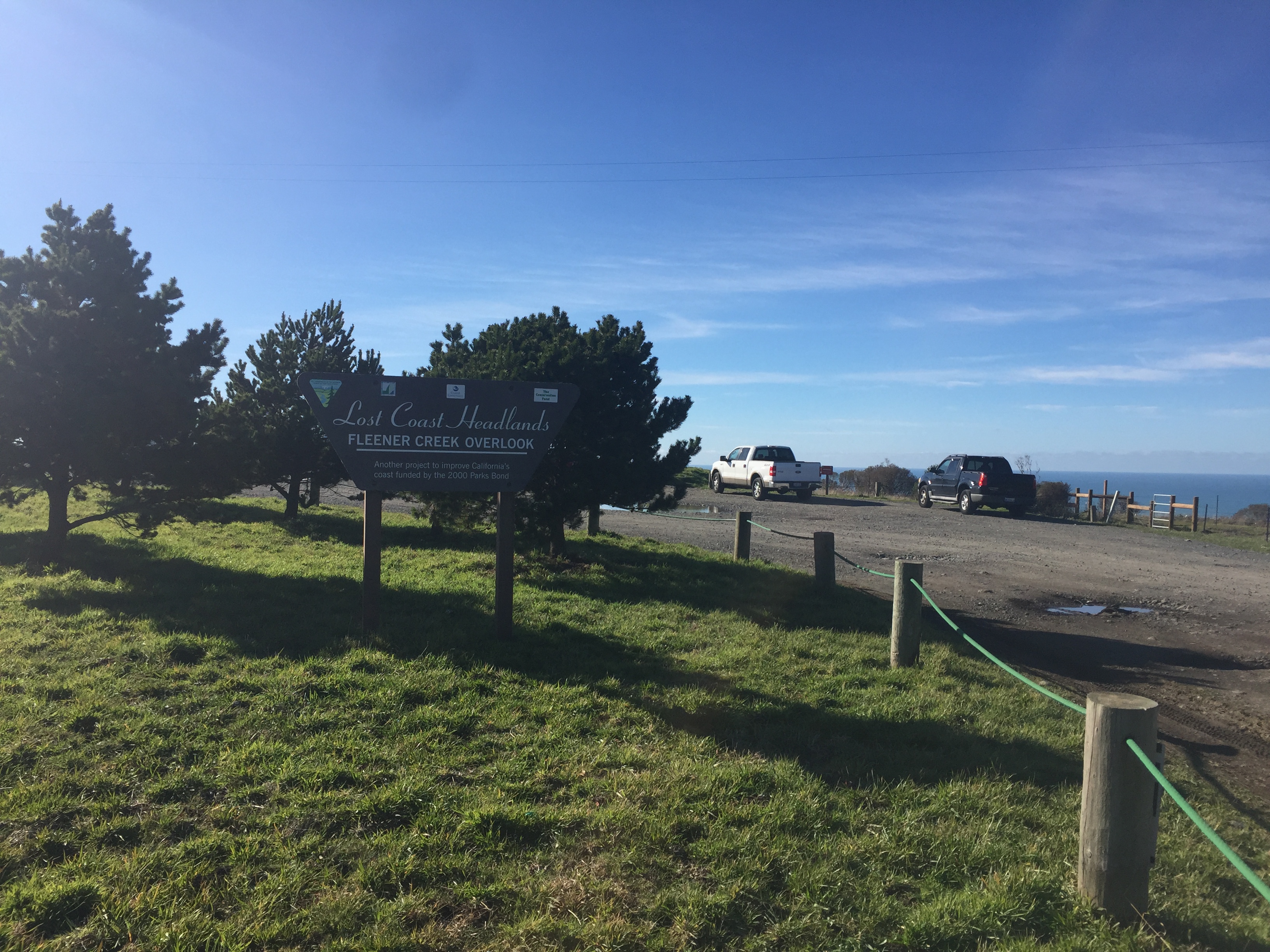
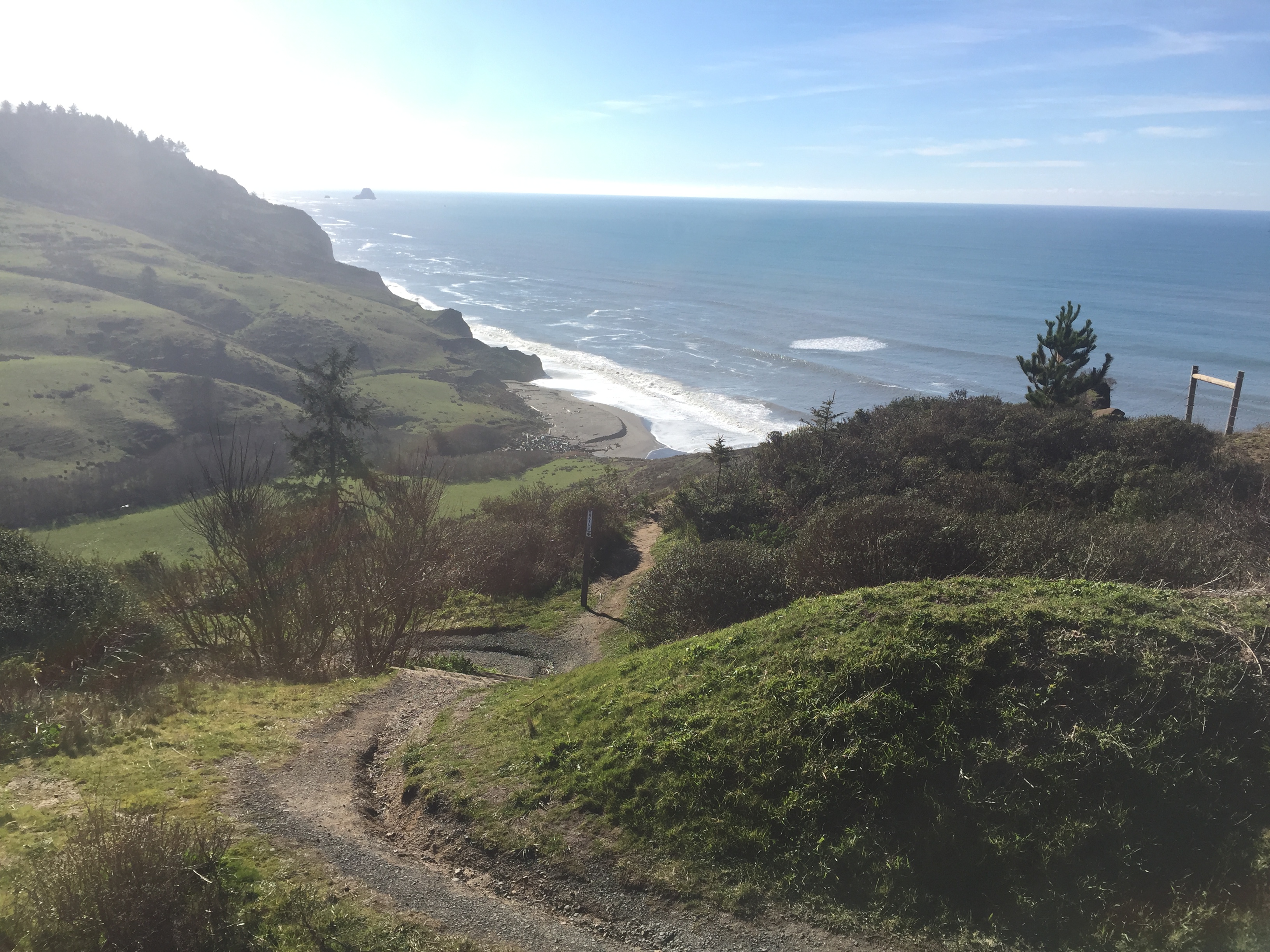
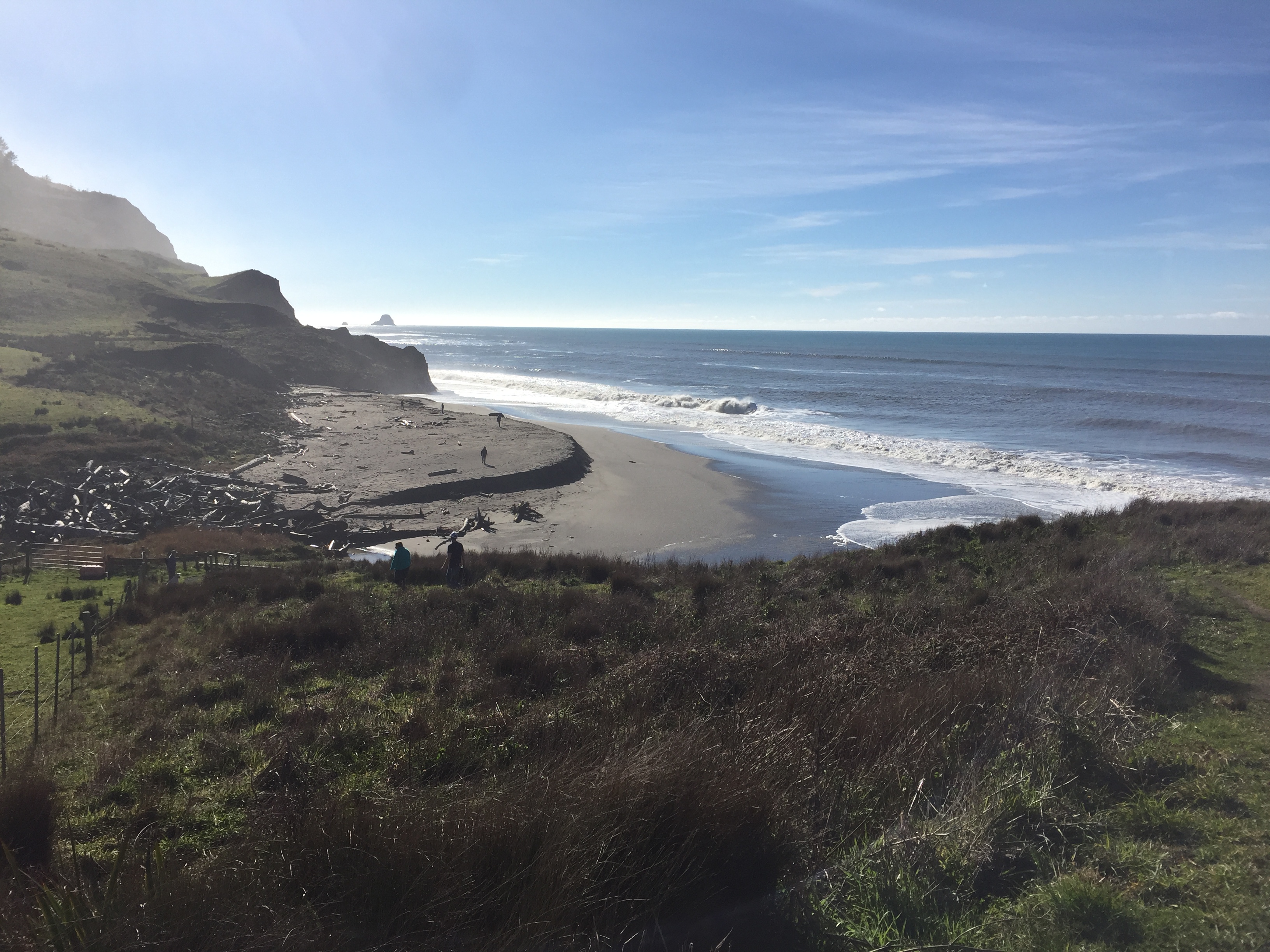
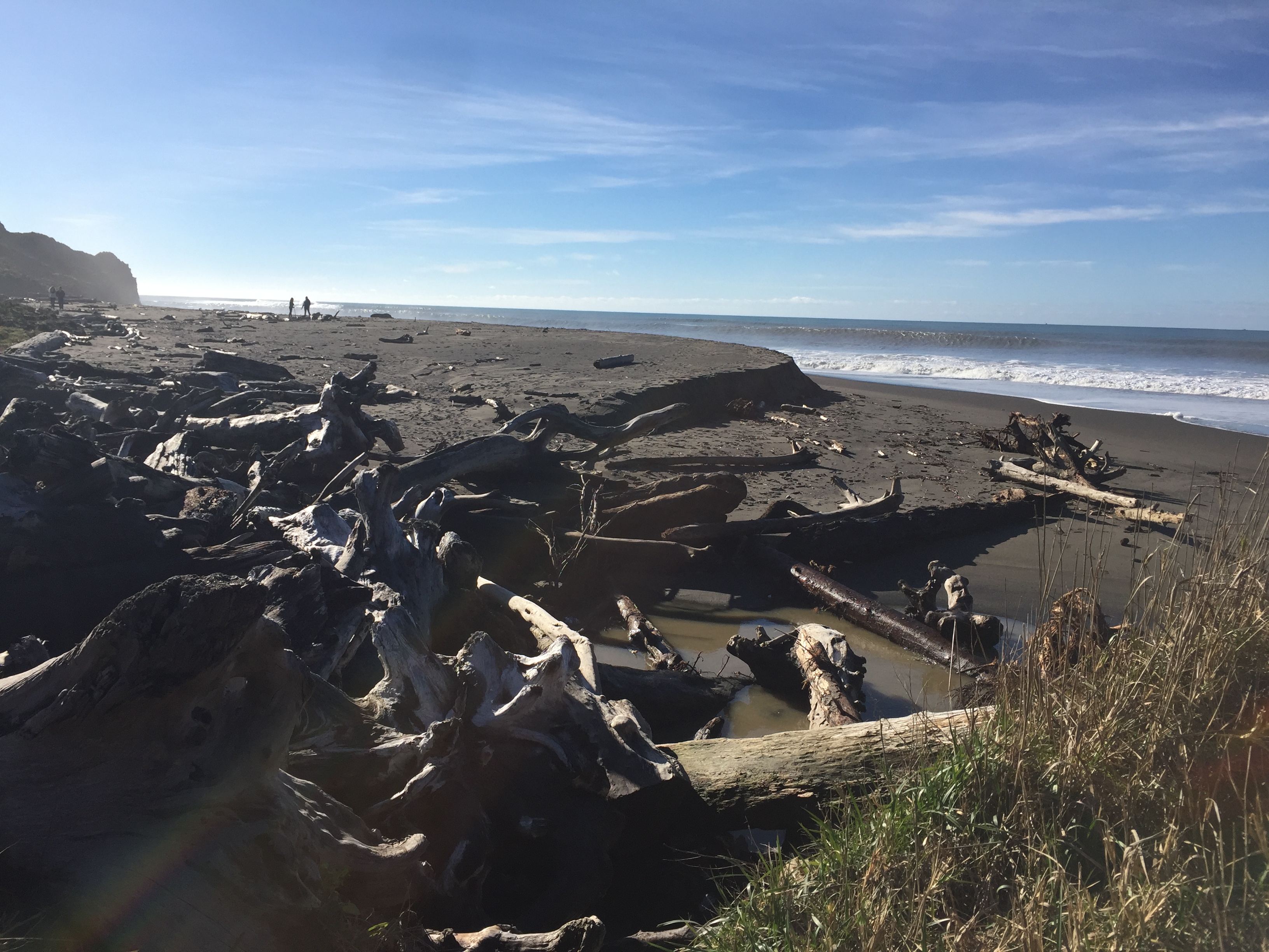
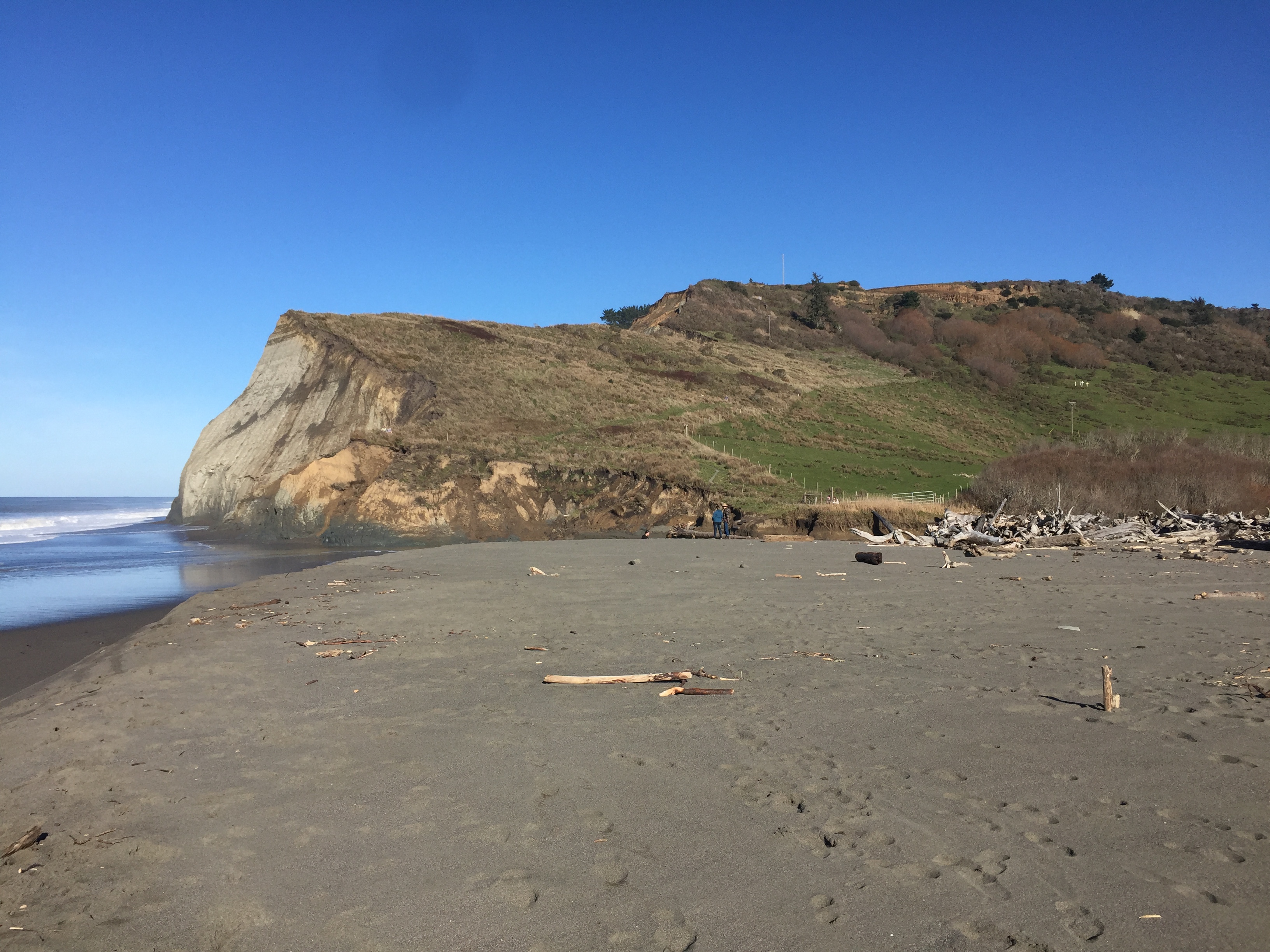
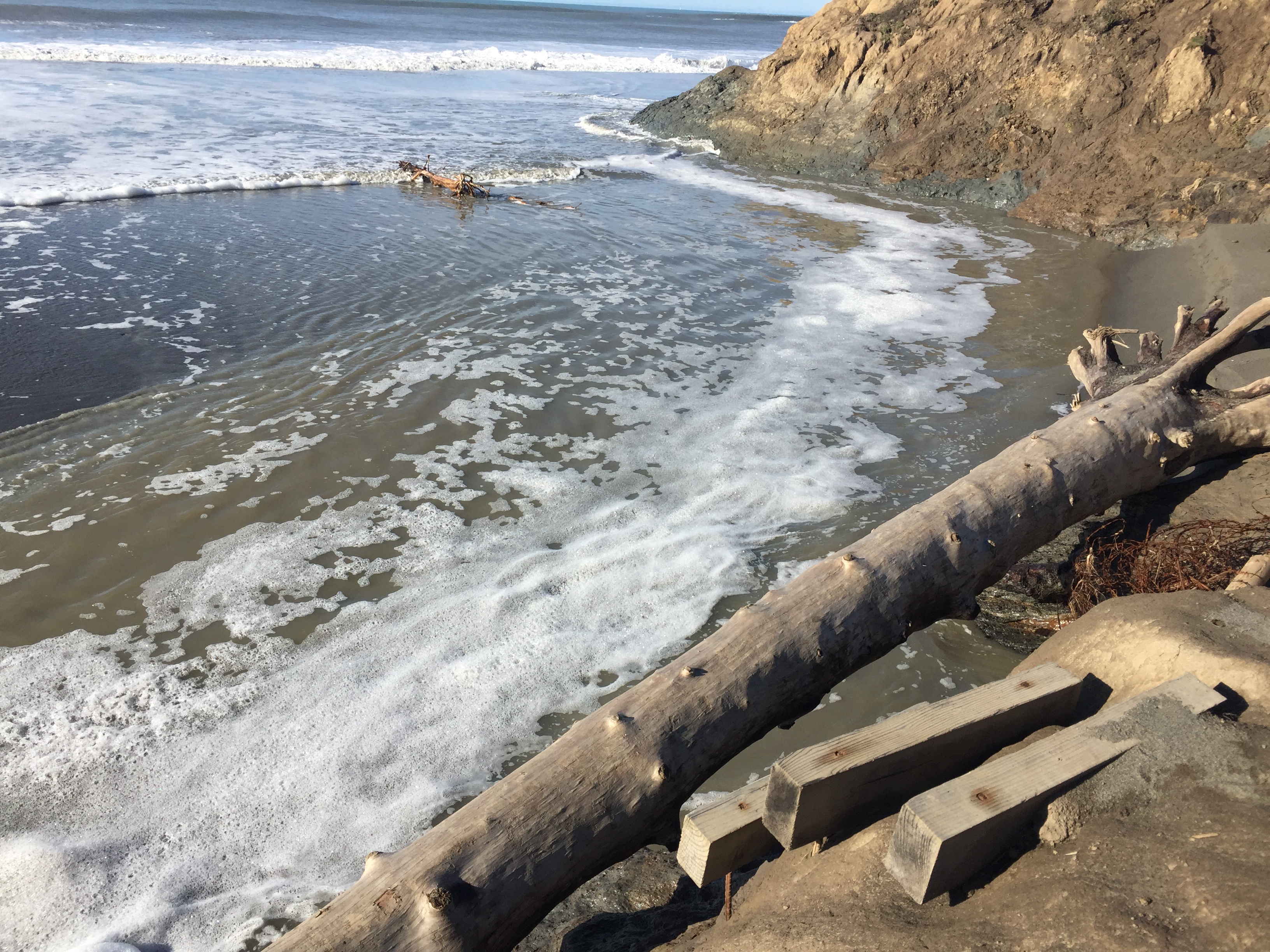
Lost Coast Headlands
Lost Coast Headlands consists of two moderate trails to secluded, rugged beaches, at the end of the road to Centerville Beach in Ferndale. The first is Fleener Creek Trail, 0.5 miles downhill to the beach. Guthrie Creek Trail is 1.0 miles downhill to the beach. Both can be difficult and possibly unsafe in muddy conditions, especially Guthrie Creek Trail that has a steep muddy patch right before the beach that some people were turning back from. Fleener Creek Trail has a large driftwood pile that must be carefully crossed, or short wood stairs leading to a creek crossing, after a steep muddy descent to the beach that a sign at the trailhead warns about. If you have bad knees or ankles, you might not want to try these trails in winter, and walking poles are recommended.
- Redwoods.info
- California Coastal Monument – BLM
- YourCaliforniaCoast.org
- 360 degree panoramas of Lost Coast Headlands
- Lost Coast Interpretive Association
- Lost Coast Trails Blog
- Guthrie Creek Trail rockslide video
- Lost Coast Headlands added to California Coastal Monument
FLEENER CREEK TRAIL – PHOTOS
GUTHRIE CREEK TRAIL – PHOTOS
Marble Rim
Mountain Biking Trails
- Paradise Ridge – King Range
- Lost Man Creek – Redwood National Park
- Last Chance Trail – Redwood National Park
- Lacks Creek BLM Management Area – Six Rivers National Forest
